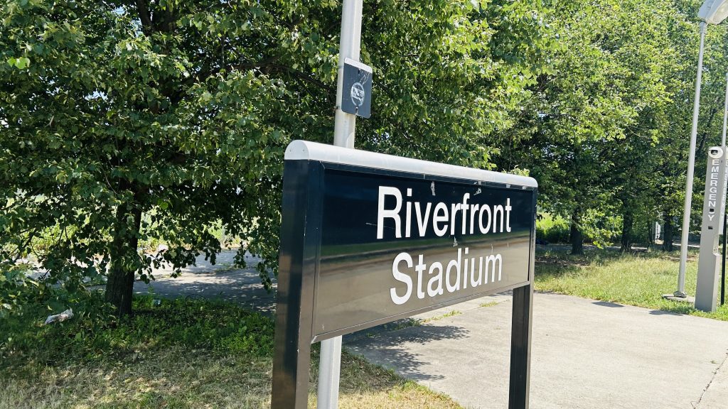
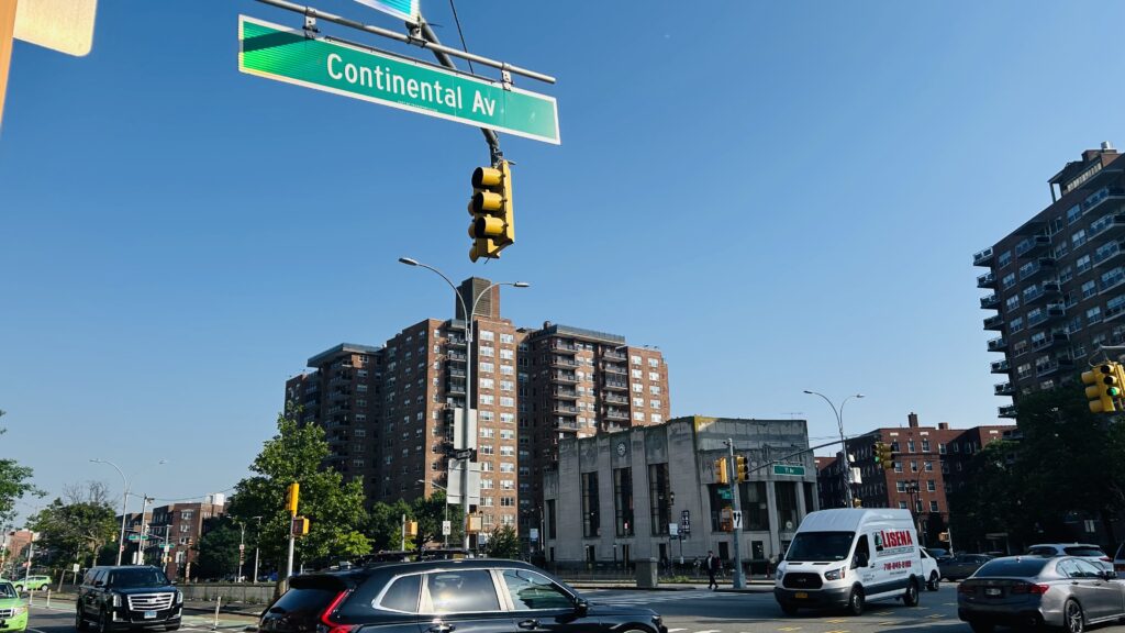
Riverfront Stadium was a baseball stadium built for Newark’s Atlantic League baseball team. Unfortunately, it was torn down in 2019, and there lies absolutely NOTHING here.
Signage
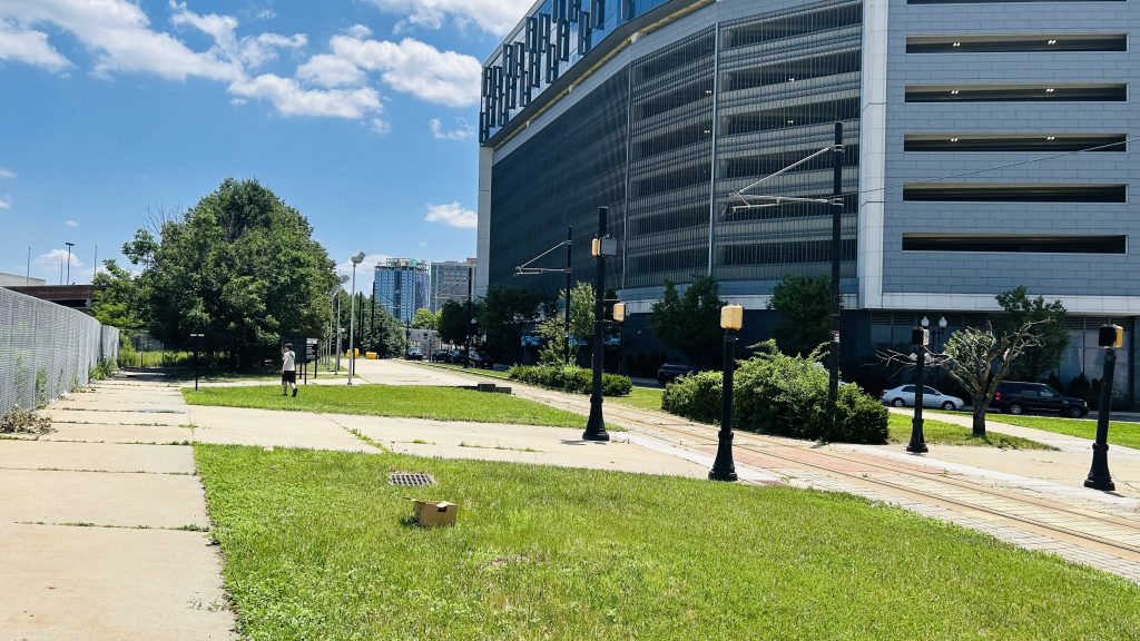
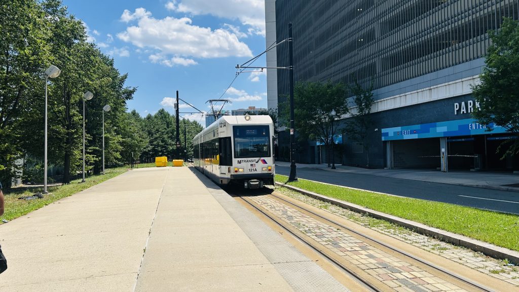
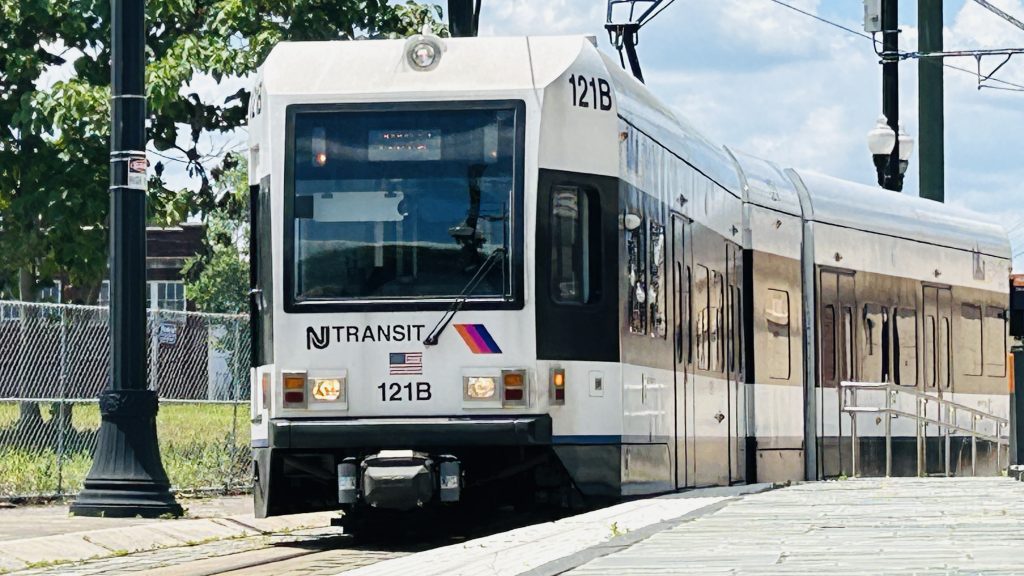
The station consists of a hunk of concrete, a sign, another sign that tells you HOW to pay your fare (yikes!), and an emergency call point. That’s it. That’s the whole station. At this point, just walk to Broad Street. There isn’t even a saving grace for this sorry excuse of a station.
Where’s the station?Oh…I’m almost certain this was taken at Broad Street instead of Riverfront Stadium, but I have to pad out the photo count somehow.
Court Square is either an elevated station or an underground station (that happens to also be a terminal), depending on if you ask the IRT or the IND. Located in the heart of Long Island City, this station has a few things going for it. Let’s look.
Signage!
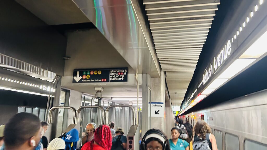
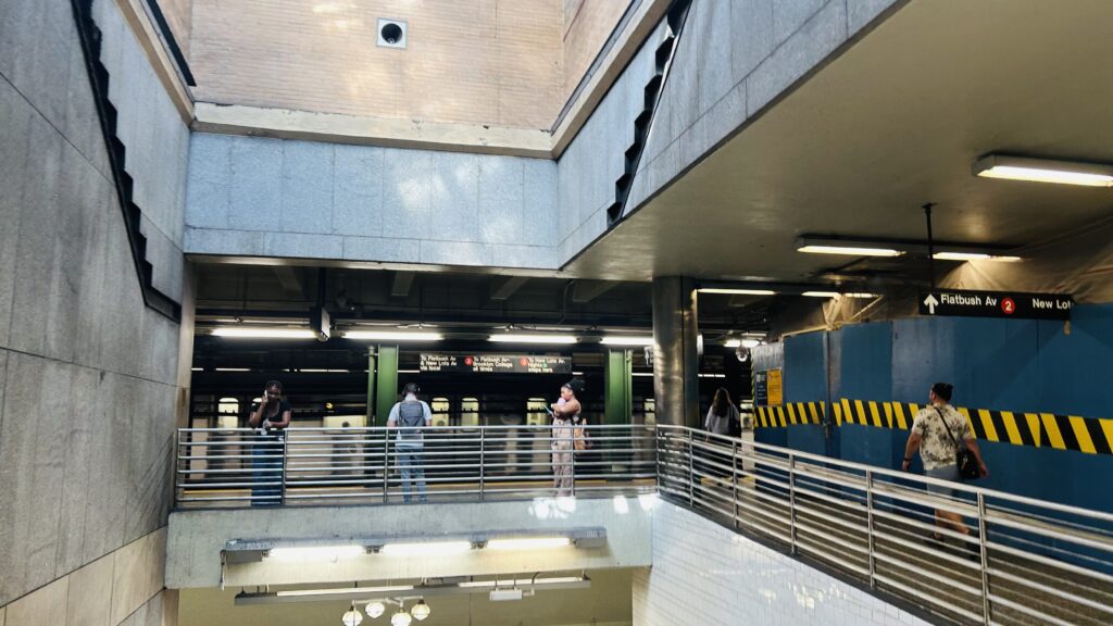
The E/F and G platforms, while separate, are connected by a rather lengthy concourse. Both platforms are largely the same, with the usual amenities. The concourses connecting them are not only long but also stupidly oversized. As for what specifically is on the platform, nothing much. Just clocks, benches, and whatnot. As for the 7, there’s an escalator heading up to the IRT headhouse encased in glass – and it looks quite cool! As for the IRT headhouse, though, there’s nothing special. It does feel weird being in an elevated station in a place as densely built as LIC, though, surrounded by glass high rises everywhere. Overall, though, not a bad station.
The next and last stop is: Court Square.GEM 7.Exit to street levelA very long concourseIt’s a tad crowded…Ramps and more faregatesThe E/F platform (at the time, E/M)Or, 23rd St.-Ely Avenue?Art!Elevator passage to the #7 lineGlass headhouse?IRT headhouseThis is a vibe.Weaving through the highrisesPLEASE STAND AWAY FROM THE PLATFORM EDGE.The Manhattan skyline
The good: It serves the heart of LIC! Furthermore, the lines are all interconnected, and it’s accessible (save for the E/F heading east).
The bad: The E/F is only partly accessible. Also, the transfer from the G to pretty much anything else can be a bit of a hike (especially to the 7).
Nearby points of interest: CUNY’s law school, some luxury housing, and whatnot. Nothing too crazy here.
Transit connections: MTA subway (Lines #7, E, F, G) MTA bus (B32, B62, Q63, Q67, Q101, Q102, Q103)
Overall, it’s not that bad and it feels weird. But, it’s not a bad station.
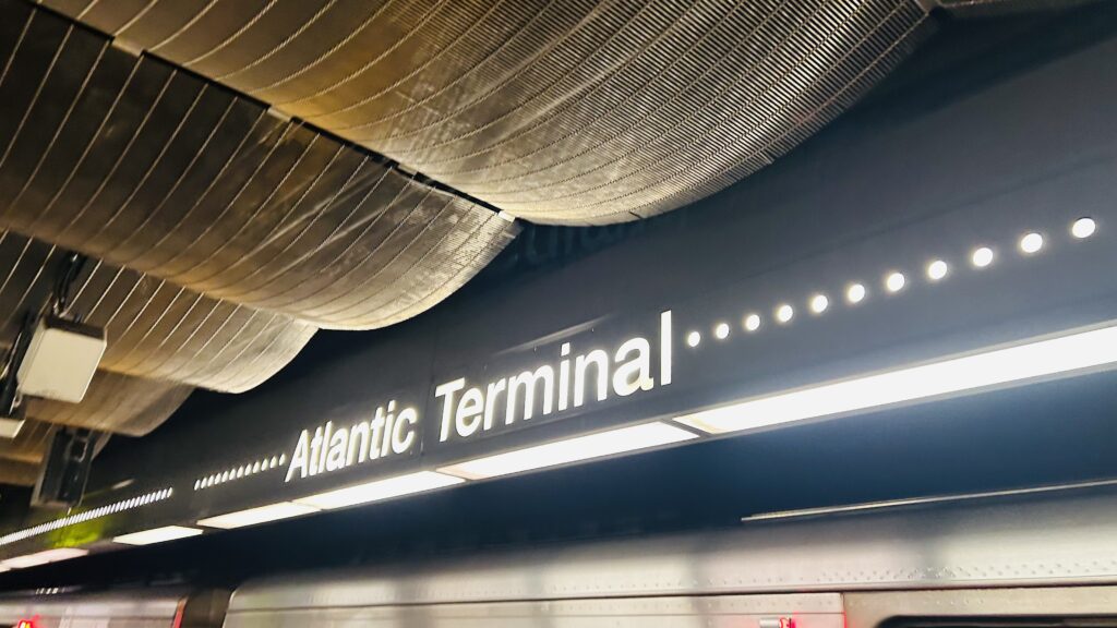
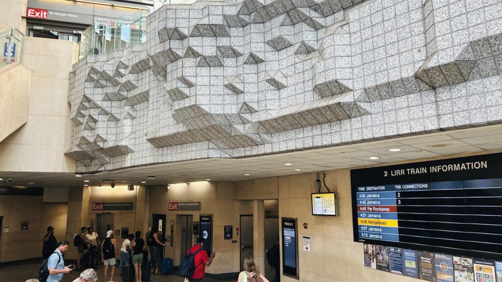
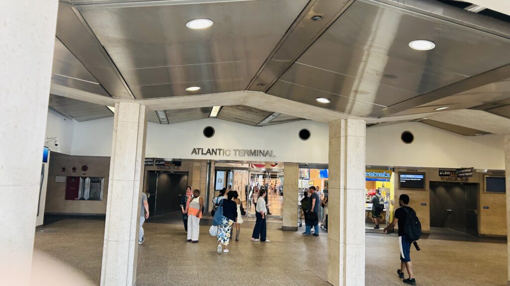
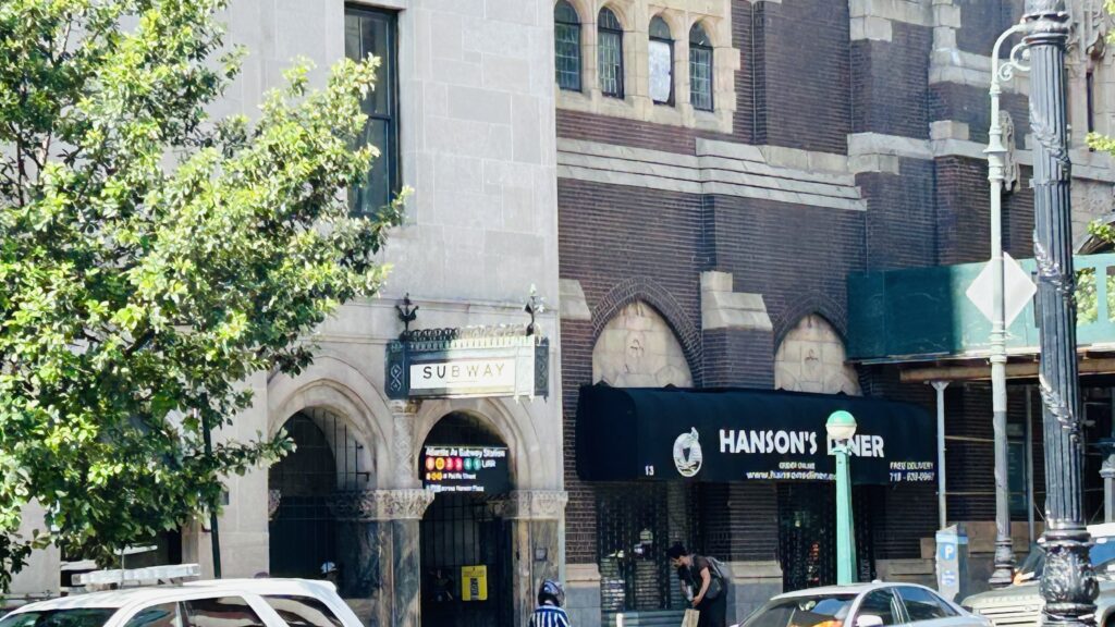
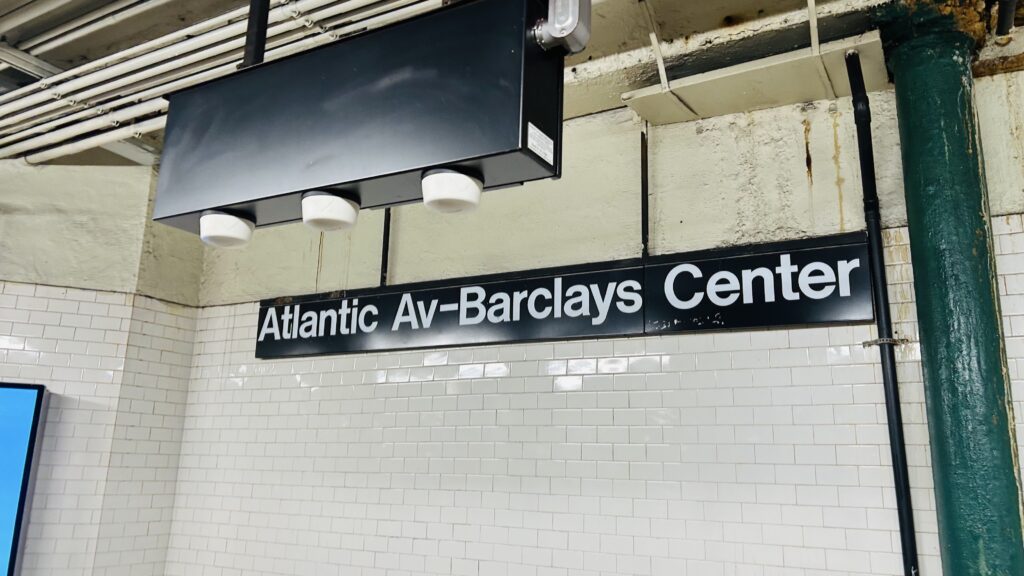
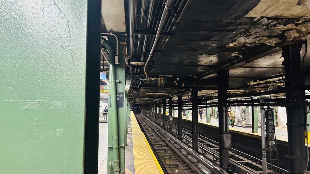
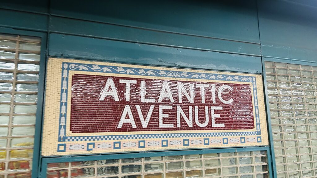
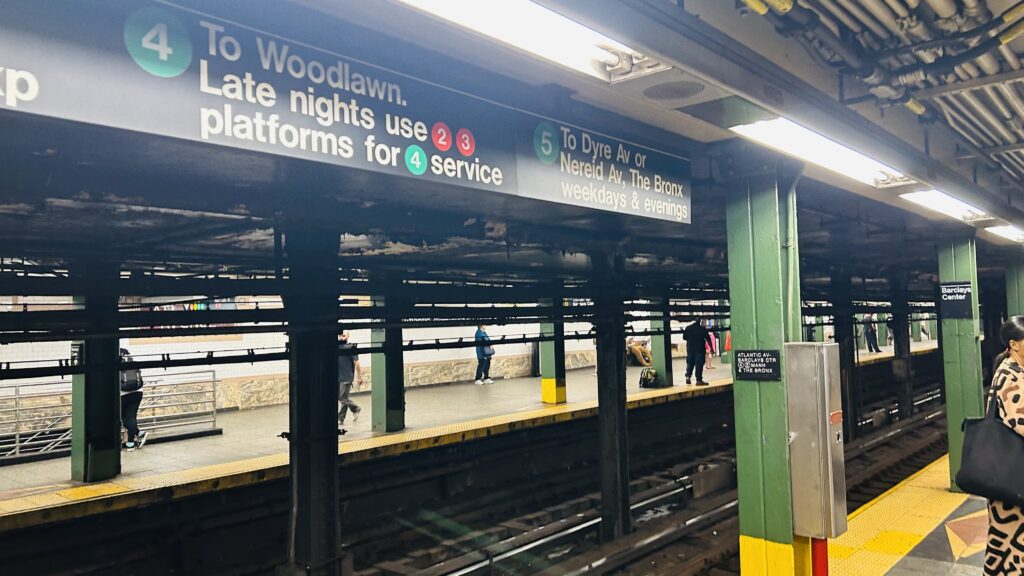
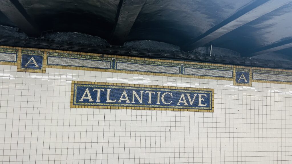
Atlantic Terminal is one of the four terminals of the LIRR within NYC city limits (Far Rockaway notwithstanding). Located in Downtown Brooklyn, the station lies underneath both the namesake Atlantic Terminal Mall, and also the Barclays Center- which, notably, is home of the Brooklyn Nets of the NBA, as well as the New York Liberty of the WNBA (remember the women). With that in mind, and with this being the heart of Brooklyn, let’s dig into this station.
Fancy!
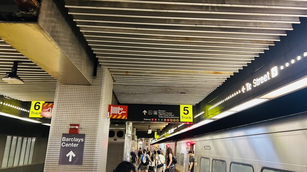
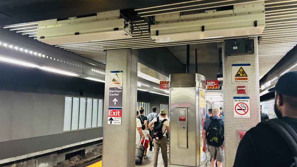
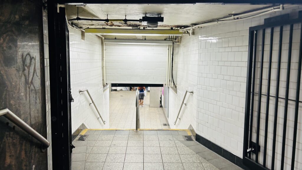
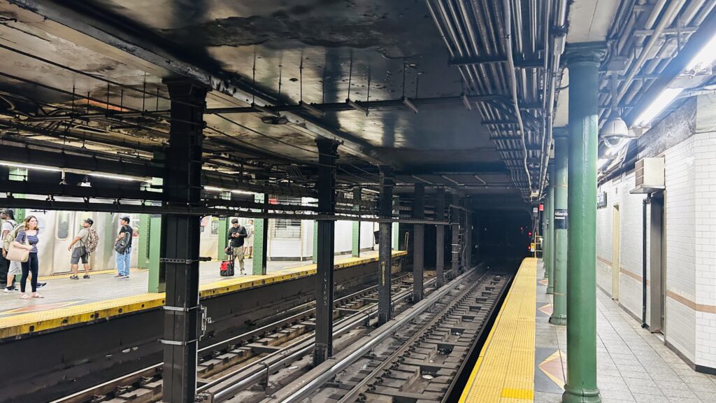
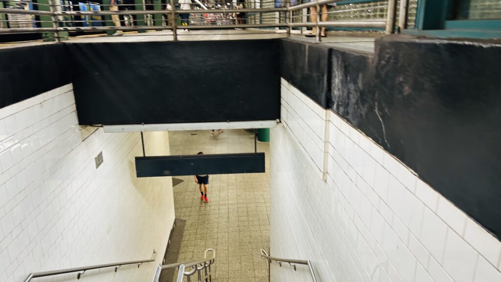
The LIRR section of the station isn’t too crazy, with a handful of platforms. For most times, the station is served by a shuttle train running between here and Jamaica Station in Queens. However, you can also catch an odd West Hempstead train, or at rush hours a train heading all the way towards Babylon or Far Rockaway. The platforms themselves aren’t that crazy. However, the concourse is also relatively small – even if it’s (surprisingly, and if memory serves) staffed. There is, however, a physical connection to the Atlantic Terminal Mall here, as well as the IRT lines! Neat!
Platform shotSignageWayfindingFare control into the subwayA direct exit onto the IRT platformsOUTTA SERVICEConcourse shotMall entrance!
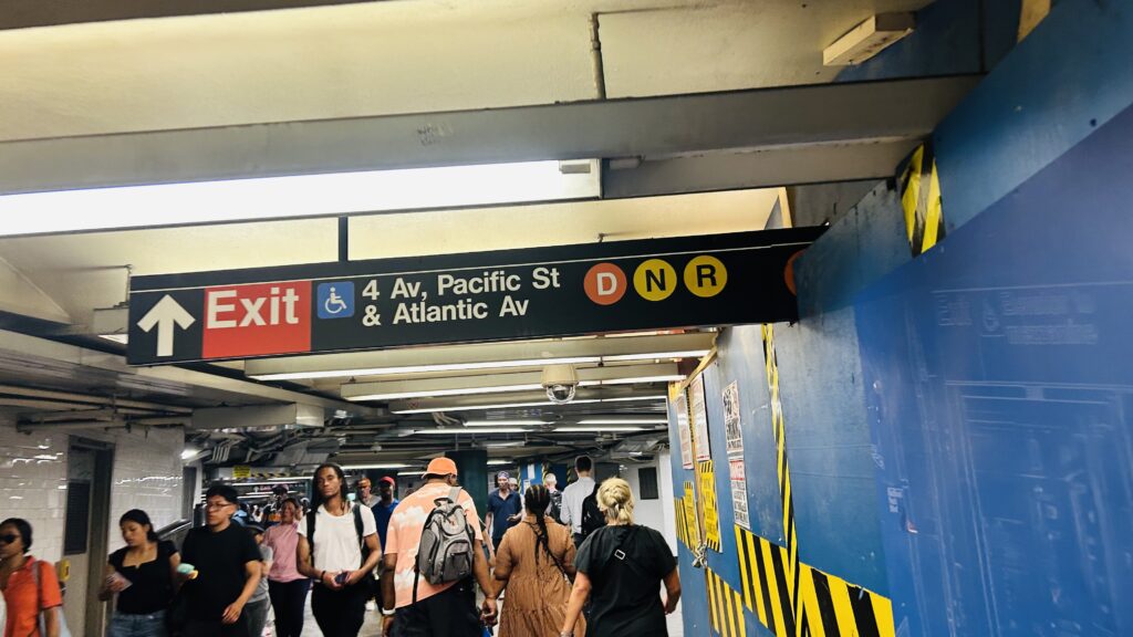
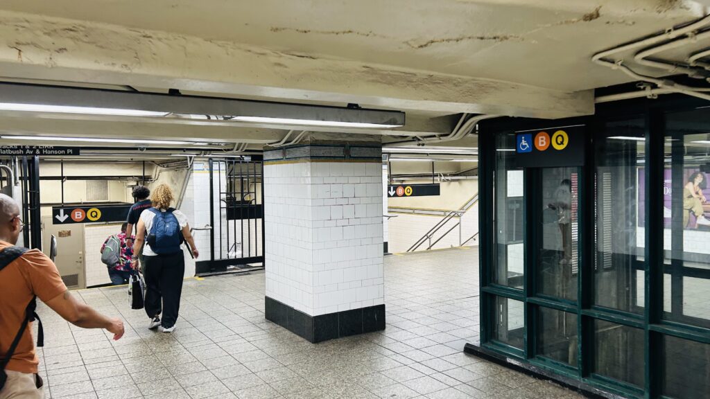
Some of the subway entrances retain their original designs (which actually looks cool!), with one such entrance being found on Hanson Place near Flatbush Avenue. Going down this one will bring you to the platforms for the B/Q, and the 2/3/4/5. Notably missing was the DNR platform – which was HELL to find. The platforms themselves look as you’d expect: tiling, usual amenities, but nothing too crazy. I really did hate finding the DNR platforms though. I mean, eventually I did. And, after finding the DNR and photographing it as needed for this blog entry, I made my way back to the BQ platform, and after witnessing someone careening down the stairs on a bicycle (ouch!), I hopped on the Q and proceeded to the BMT shuttle. Overall, nothing insane.
Headhouse!EntrywayIRT platforms!Subway signageLooking up the tracksMOSAICAnother passagewayDyre? Never met ‘er.ConstructionDNR!I sure would hate to come careening down these stairs…BEE CUE.MORE MOSAICSO MIGHTY R68, PLEASE TAKE ME AWAY!!!
The good: It gives Downtown Brooklyn a direct connection to the LIRR network. Furthermore, it’s one stop short of the heart of the BMT (DeKalb), even though arguably this is more important as more BMT lines serve here. It’s also got direct access to both a mall and a sports arena. Neat!
The bad: Trying to find the right passage from the BQ to the DNR can be very tricky.
Nearby points of interest: You may see signs that say “BAM!” on them. That’s actually just the Brooklyn Academy of Music. There’s also the Atlantic Terminal Mall and the Barclays Center, a state DMV branch, and an Apple Store.
Transit connections: LIRR (Brooklyn Shuttle, West Hempstead, Far Rockaway, Babylon, Hempstead) 7th Ave. IRT (Lines 2, 3) Lexington Ave. IRT (Lines 4, 5) Broadway BMT (Lines N, Q, R) 6th Ave. IND (Lines B, D) MTA bus (B41, B45, B63, B65, B67, B103)
Overall, it’s not too awful a station, but it’s one that’s REALLY annoying to navigate. Yuck. I’d argue this is even worse than Penn Station on that front.
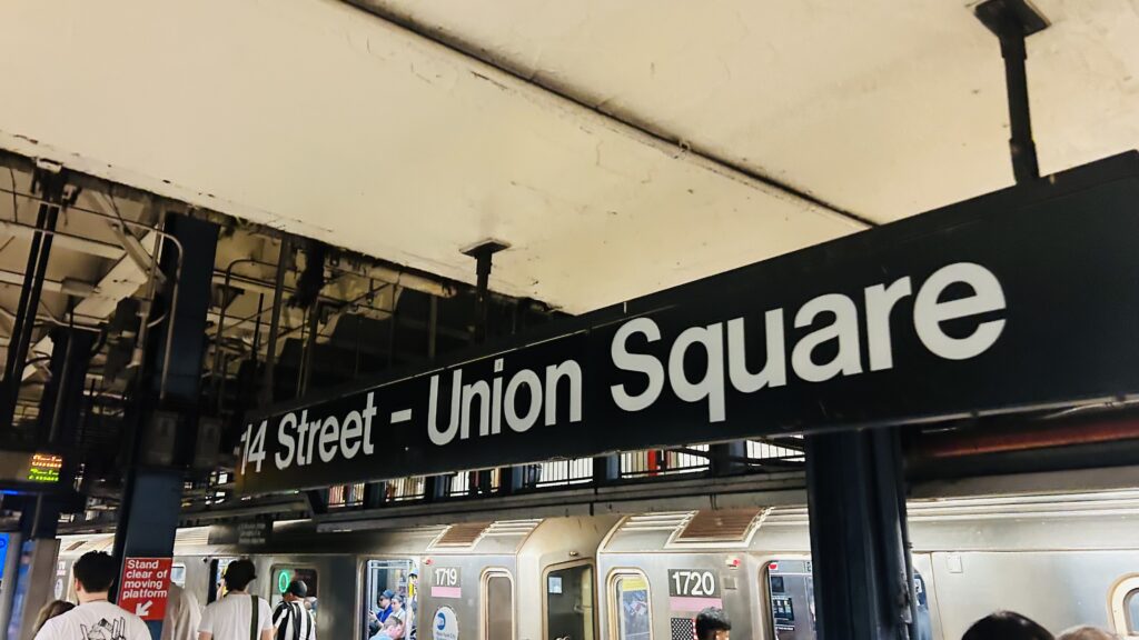
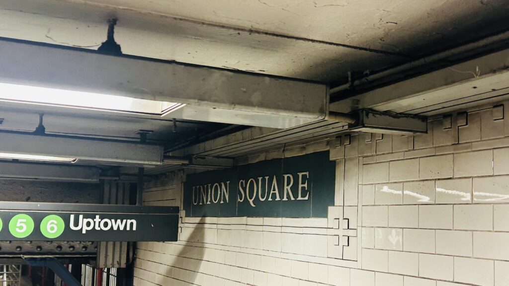
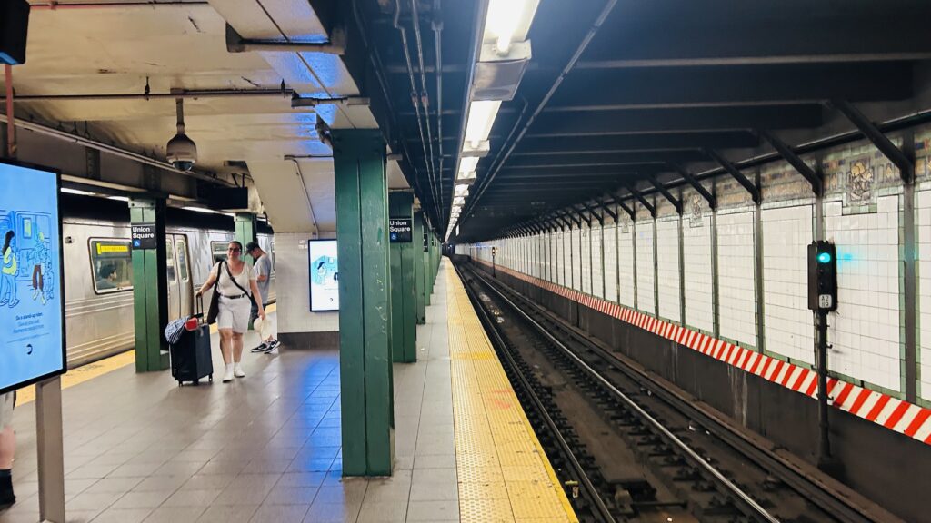
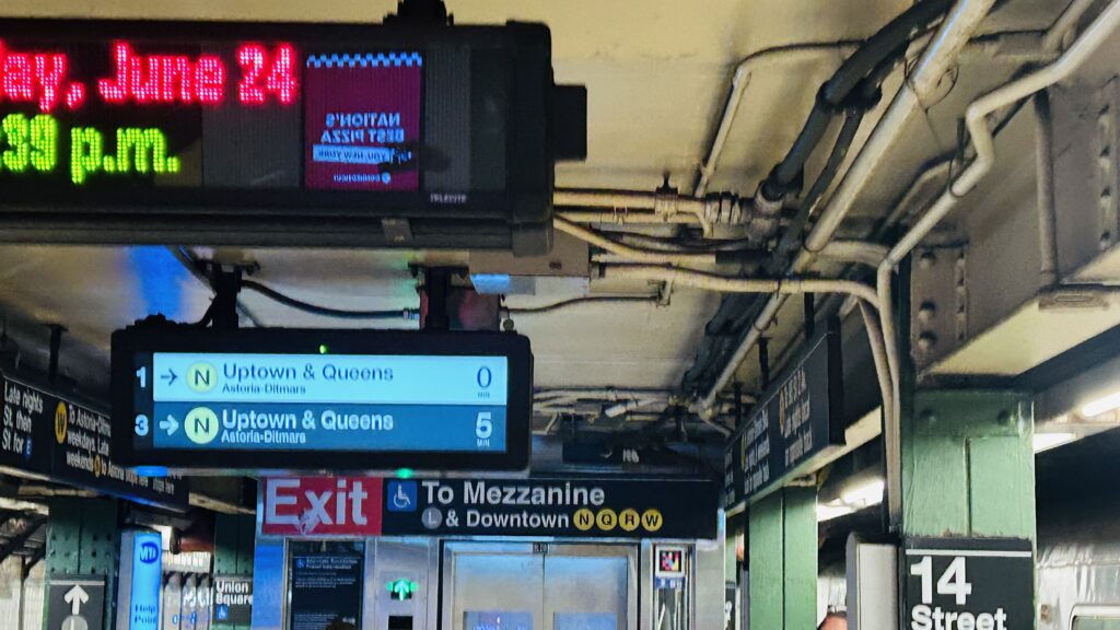
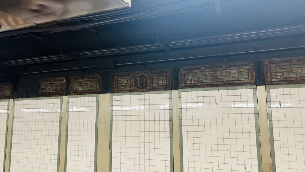
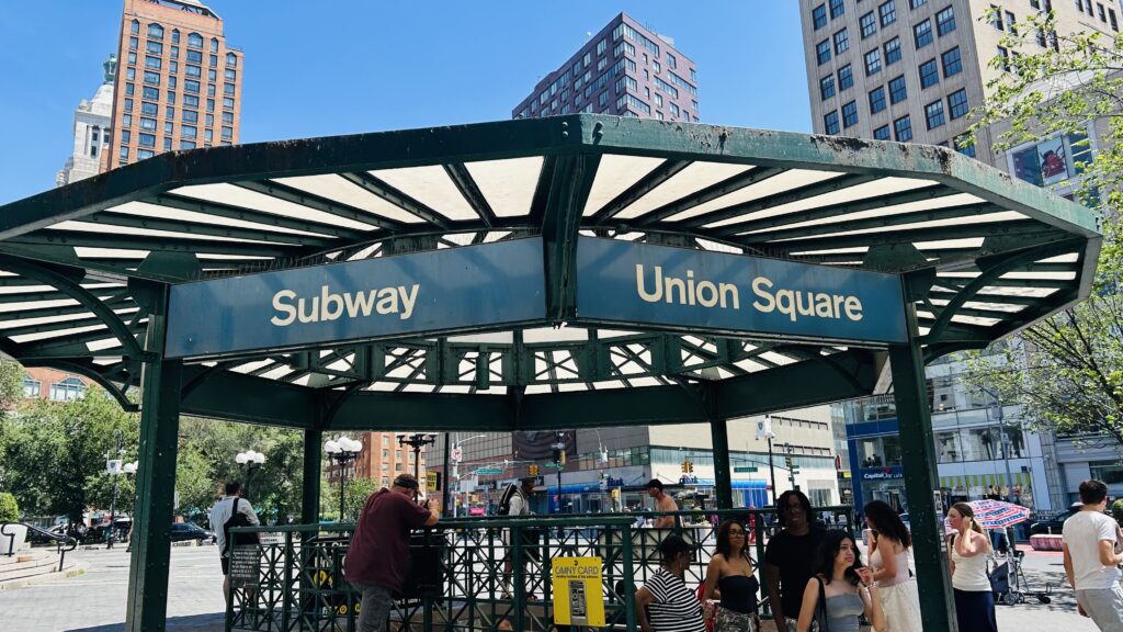
On this day in 2022, Union Square station opened up, serving the D- oh, wait, wrong station? Oh, ohhhh, this is FOURTEENTH STREET on the IRT and BMT! Okay, I get it now!
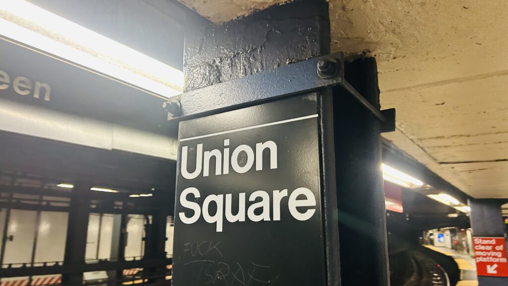
Signage!
So, Union Square is located under its namesake park, and serves both the IRT (the #s 4, 5, and 6 lines) and the BMT (L, N, Q, R, and W) lines. As such, it’s also a transfer point between the IRT and BMT lines. Let’s look at it.
Pole signage
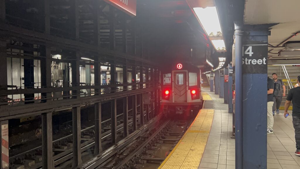
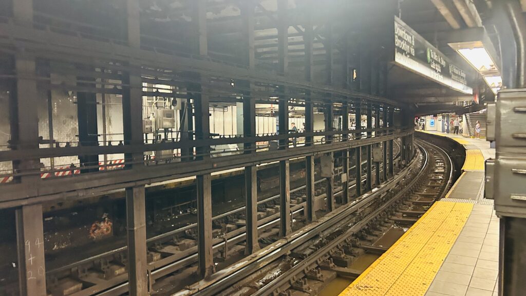
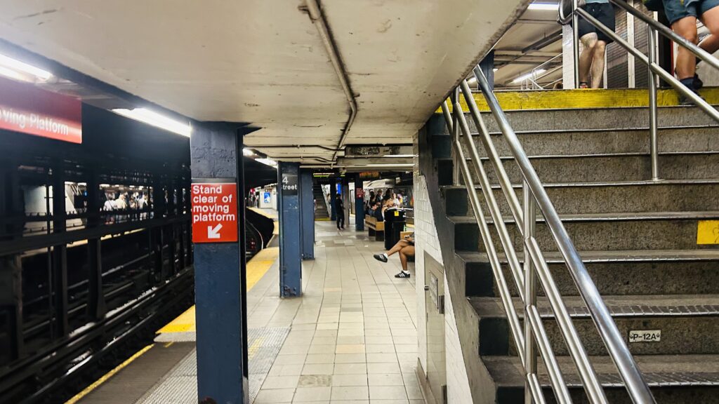
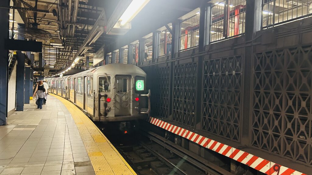
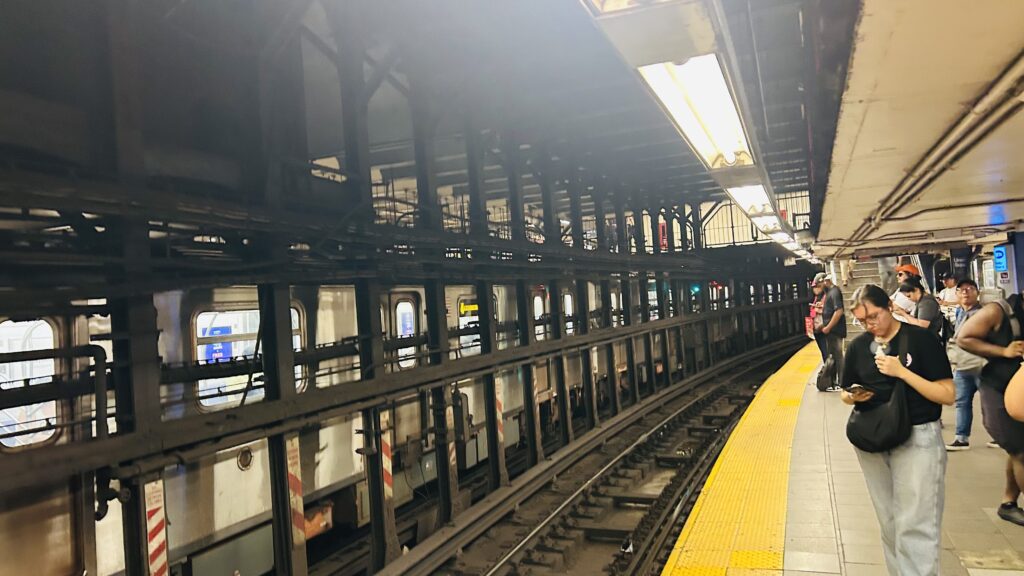
The IRT section is an express stop (serving both the 4 and 5, along with the 6) and is rather unique. While it isn’t accessible, the tracks are curved going into the station, and even considerably inside the station itself. This means the platforms need gap fillers and a reminder that, to sum up the British, one has to MIND THE GAP. Otherwise, it’s standard for an inaccessible express station. Nothing to remark otherwise aside from the coolness factor of a severely curved platform. But, no seriously, mind the gap please.
There she screams…CURVY!!!Platform shotThe mezzanine aboveA local train curving inThe mezzanineUNION SQUARE
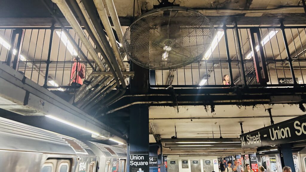
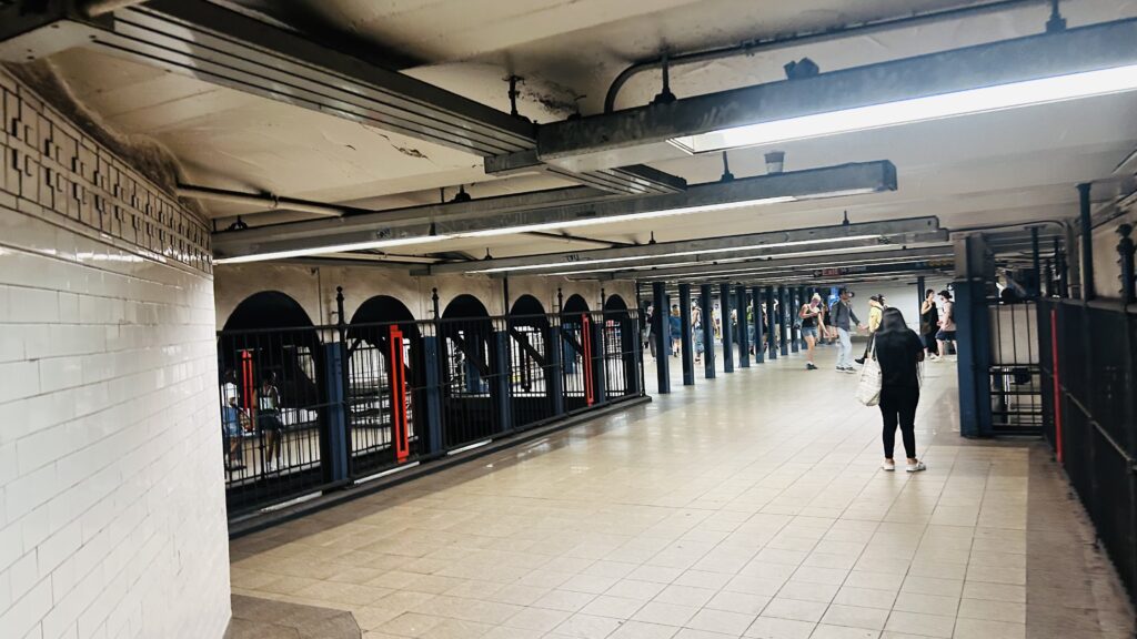
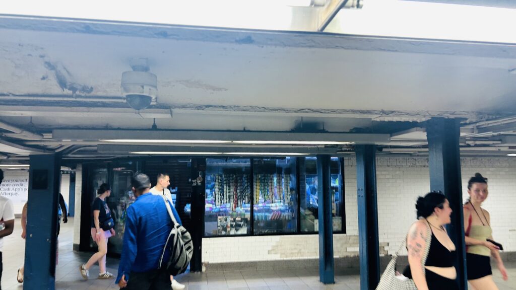
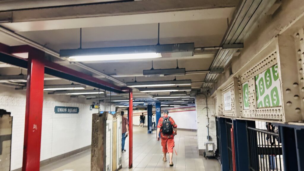
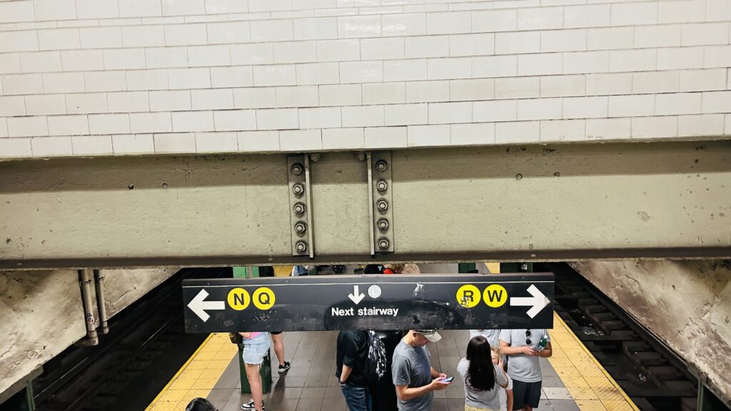
Moving on to the BMT platforms, they’re both normal. Nothing special. Both are accessible, have the usual amenities, and whatnot. This is a local stop (as are all stops) on the L (Canarsie/14th St.) line, and an express stop on the NQRW (Broadway) lines. Furthermore, there’s OMNY machines and a staffed booth in the mezzanine, and you even have some shops outside fare control. Neat! There’s even a rather cool-looking headhouse in Union Square Park itself. Did I also mention there’s a lot of buses here, too? Many of which happen to be useful as well?
One more uptown IRT shot for good measure.One such shopOne of the corridorsThe rather normal BMT express platform for the NQRWAnd another shotTwo types of clocks, and the elevatorWayfinding that wasn’t entirely helpfulStairs!Transgender representation? In MY Union Square?! APPROVED.“take an L” except it’s …sorta good?BMT tiling!It was busy.Faregates!Headhouse!
The good: It’s a REALLY busy station, with both a number of local and express buses, along with the 4/5/6 lines, the L line, and the NQRW lines as well. It’s located right on the borderland of what’s generally considered “lower Manhattan” and “not lower Manhattan” (14th St. itself is generally seen as the cutoff, from what I could find). Also, it’s the 4th-busiest station on the entire system. For context, the other top 3 (Times Square, Grand Central, and Herald Square) have also been covered here.
The bad: The only real stinker is the IRT platforms being inaccessible. That’s actually kinda scary, considering this is the 4th-busiest station on the entire system.
Nearby points of interest: Union Square Park, various shops and restaurants, and the obvious case of housing. I will note though, I did get the impression most restaurants nearby aren’t exactly affordable to a more normal person like myself. There is also a holiday market, from what I was told, if you happen to be in the area during the Christmas shopping craze. There’s even a farmers’ market!
Transit connections: Oh boy, this one’s a doozy. Lexington Ave. (4, 5, 6) BMT Broadway (N, Q, R, W) Canarsie/14th St. (L) MTA bus (M1, M2, M3, M14A-SBS, M14D-SBS, SIM1C, SIM3C, SIM4C, SIM7, SIM9, SIM33, SIM33C, X27, X28)
Overall, for usability, it’s a very important station, and the adjacent park is kinda nice too! It’s kinda scary how it’s not accessible despite being up there in the top 10 most-used stations system-wide though.
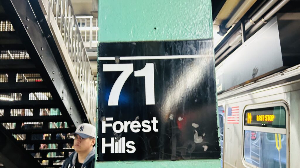
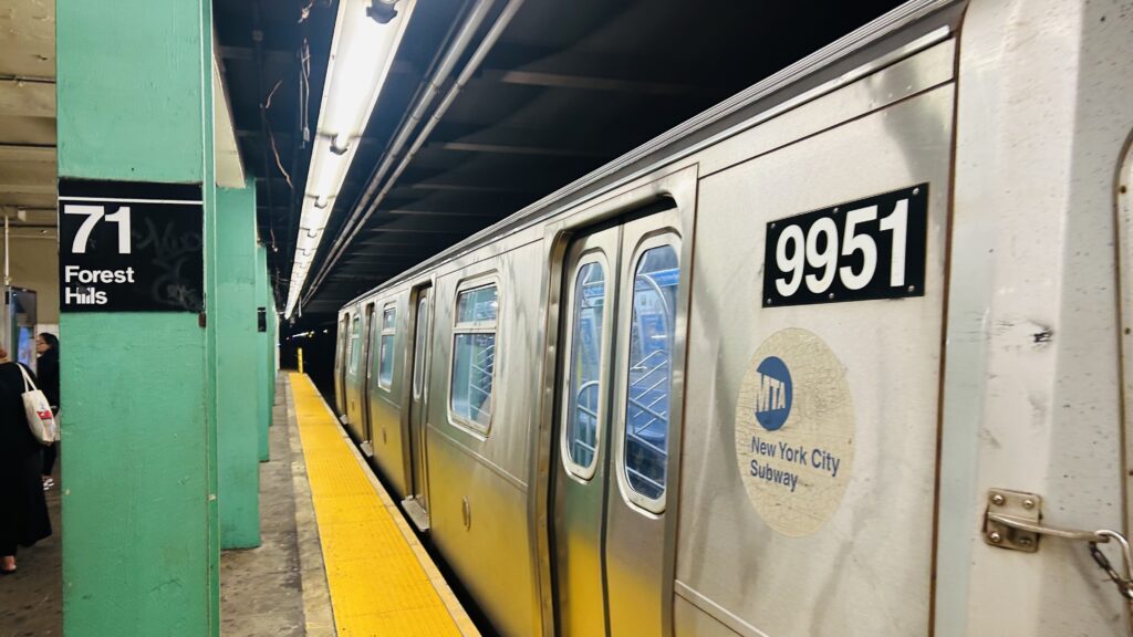
Wait, didn’t I already cover Forest Hills? Well, yes, but not in NYC. And, there’s a second station here also carrying the name – albeit that one is served by the LIRR. That one is coming a little later, as today’s focus is the subway.
Pole signage
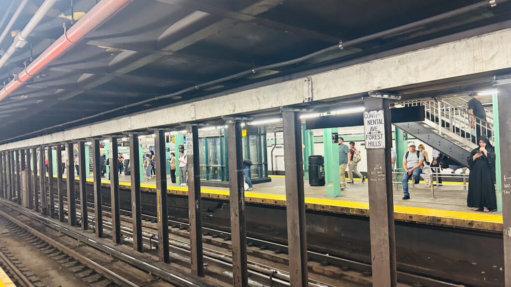
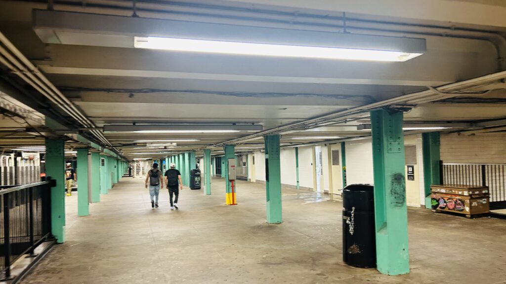
So, the M/R both terminate here, and historically the G has also terminated here (but not since, iirc, 2010). However, the station is your standard express configuration with two islands. The platform is pretty standard with benches and clocks and whatnot. As for the track layout, there’s a big mess of crossovers spanning two levels beyond the station, with the upper level primarily being used for continuing trains (the E to Parsons Blvd. and the F to 179th Street), and the lower level being used for access to Jamaica Yard (primarily supplying service to the E, F, and R lines). It’s oftentimes said that this station also kinda sucks as a terminal, but I don’t know enough about NYC terminal ops to make a judgement call on that. As for the mezzanine, it’s your standard affair for the IND. There’s also the LIRR a stone’s throw away. Neat! It’s also an accessible station. From here, the next stop outbound is Kew Gardens on the E and 75th Avenue on the F.
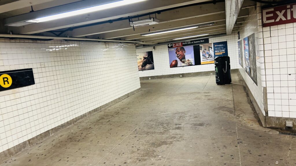
UH OH…UselessAccessible!When Queens Blvd. goes belly up…Classic IND mezzanineEFMR.Street level exitWelcome to Forest Hills! (also Queens Blvd. is wide as hell)EXPRESS BUSES?! why would anyone take them from here when the subway exists?!
The good: It’s accessible, and has a good amount of transit connections!
The bad: The station really sucks as a terminal! (as far as I understand, anyways – and I’m inclined to believe this given my experiences with signal issues!) But also, Queens Blvd. itself is wide as hell. That isn’t good! If you don’t know what exit to take, you may have to hail Mary across it to reach the LIRR! Yikes!
Nearby points of interest: There’s ..a tennis stadium???? But also, shopping, housing, and what looks like a very wealthy neighborhood.
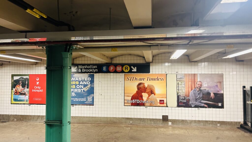
Transit connections: BMT-Broadway (R) IND-6th Ave. (F, M) IND-8th Ave. (E) MTA bus (Q23, Q60, Q64, Q74, QM4, QM11, QM12, QM18, QM42, QM44)
Overall, the station itself is pretty normal, and there isn’t a lot to remark about. Yet another standard IND station.
Radnor is a station on the weird mode of transit known as the Norristown High Speed Line (or the M). It’s located in Radnor Township off King of Prussia Rd., in suburbia. Let’s look at it.
What ya see is what ya get. This is it. The whole station.
The station consists of an inaccessible footbridge, a shelter with a bench and wastebaskets, and even some parking. Is there anything else? No? Cool. That’s it. That’s the whole station. Well, aside from a bus connection on King of Prussia Road, but that’s it.
eh?Towards 69th St. (hehe nice…)Towards Norristown – this feels actually a little rural…Overpass shot!Parking!And another scenery shot
The good: It exists? It can theoretically be a park & ride?
The bad: It’s inaccessible (except on the inbound side?) and it’s also stupid close to a number of other stations. The connection to Regional Rail(TM) is also not convenient – yet in spite of this rather major shortcoming, Regional Rail(TM) STILL is more accessible than this rinky dinky little station.
Nearby points of interest: An office park and Radnor High School, I guess? If you walk a little further (per Ranya), you can get to Micro Center!
Transit connections: Norristown HSL SEPTA bus (106)
Ah, W. 4th, or I guess operationally, the heart of the IND network. (as all the ex-IND lines aside from the G and the far-flung shuttle converge here). So, surely this would have to be some big, grandiose station, right? Well…
Signage
The station is located along 6th Avenue, spanning between West 3rd and West 8th Streets, and is REALLY close to PATH’s 9th St. station. With that in mind, and with this being the beating heart of the IND (if something goes wrong here e.g. a switch or signal dies, then the entire IND network is functionally knocked out – essentially, the IND’s version of DeKalb. I could not find a comparison for the ex-IRT lines), surely it is grand, no?
WRONG! It’s just about as standard of an express IND station as one can get. I mean, you have elevators. And, the layout is unique with the mezzanine sandwiched between the ACE above and the BDFM below. This is also the point of no return for trains that need to be re-routed (e.g. E via F, or D via A) before meeting back up with their respective original routes. But, for the platform, it’s standard with all the amenities. Sometimes, it might reek of piss though, however out of the handful of times I actually used this station, I have not encountered such a problem. But, sometimes, being a normal station, if important, is a good thing.
Elevator constructionFaregates!It’s a bit cramped…A Lefferts-bound express trainDownward to the mezzanine?Expansive!The F line!Classic IND tiling jobIt’s quite a busy stationBOUTTA RIDE THAT D!!!
The good: It’s literally the heart of the IND. Every IND line converges here except for the G and the shuttle, and it’s got various buses as well. Furthermore, it’s in a pretty lively part of Manhattan that isn’t as swarming with tourists (but I’d argue is still worth visiting as one, as a personal suggestion). It’s also accessible!
The bad: I mean, it blends in with the rest of the IND, but that isn’t always bad. Its’ importance as the heart of the IND network means one failiure here and the A/B/C/D/E/F/M are handicapped severely. (or in the case of the F, rerouted via the G sometimes). It’s important but fragile as far as infrastructure goes.
Nearby points of interest: Many of the same places as noted on the 9th St. PATH entry, and for Christopher Street apply here too, however this station is a little closer to NYU than 8th St. is on the BMT. Furthermore, you have Washington Square Park, various entertainment venues, and whatnot.
Transit connections: 8th Ave. IND (lines A, C, E) 6th Ave. IND (lines B, D, F, M) MTA bus (M8, M55, SIM7, SIM33, SIM33C, X27, X28) At 9th St.: PATH (JSQ-33, HOB-33)
Overall, it’s not a bad station. I’d probably give it an average-ish score that I give to stations that aren’t awful, but don’t have much to remark. But, this is one case where its usefulness elevates the score a bit.
Douglaston is a station on the Port Washington Line of the LIRR located in eastern Queens, in the Douglaston neighborhood. Let’s take a look at it.
Rather dark signage
My train here was running a bit late because of the hordes of passengers that got on at both Woodside and Mets-Willett Point (there was a Mets game that night), rendering the train to both be nearly crush-load for a little bit AND for a 12-car set to be used (which cannot platform fully pretty much anywhere on the line aside from Woodside and Penn Station/Grand Central Terminal). As for the station itself, you have a station house (which was surprisingly open at the hour I was here – 11pm?!), level boarding, ticketing machines, a shelter to wait in outside the station house, and even a kiss & ride on each side. As for land use, it’s eastern Queens. You have a small and relatively low density business district around the station. As for accessibility, while the station is accessible, one has to go around and cross via Douglaston Parkway for step-free crossovers. Which can take a while (about 10 minutes, measuring it out). Yikes. Overall though, not a bad station!
Parking! (it’s kinda dark…)Departure board!More parking!Train meet…..at night!See ya!!!The other side…..at night!Little Neck Bay…at night!The platform shelter…….at night!Station house!It’s a bit dark…The local neighborhood………at night!If it weren’t for the fact this neighborhood is largely dead at 11pm, this would be sketchy.Tunnel!AHT.The station house and TVMsAnother neighborhood shot at nightLIRR x the Pennsy?The waiting roomAll red departure board?That’s a rather long trainwoah…
The good: It serves the local neighborhood and is (technically) accessible! Also, service to Manhattan is rather frequent being half-hourly! There’s also a station house that’s open during most hours (seemingly), which can’t be said for most stations I’ve reviewed here.
The bad: WHY IS THERE NO RAMP GOING UNDER THE TRACKS?! DOES THE LIRR HATE ACCESSIBILITY ON THIS LINE OR SOMETHING?!
Nearby points of interest: there’s a whole mini-downtown area here! There’s also a school, a church, and the Allen-Beville House.
Transit connections: LIRR (Port Washington) MTA bus (on Rt. 25A) (Q12)
Overall, it’s not a bad station, and the area around it is kinda nice. If anything, I should probably come back during the daytime and check some stuff out.
Alrighty, so the second local stop on the F/M between W 4th and 34th, let’s look at it. It is a bit unusual though, but here we go.
…PATH signage?
The PATH platform is pretty normal, with not a lot going on. There’s stairs down to an underpass, some benches, among other things. The track layout of the station is rather unusual, with the F/M flanking the PATH platforms. As for the station mezzanine, it’s normal with OMNY machines, fare control for both PATH and the MTA, and a station agent. I’ve somehow managed to completely forget to photograph the MTA part of the station (don’t ask how), but I can assure it’s nothing crazy and has your usual station amenities. Street level also doesn’t have anything crazy, maybe aside from the M23-SBS.
ILLEGALPoles galoreNext and last stop is 33rd Street.WayfindingAnother platform shotThe stairs …down?FaregatesWayfinding!The station mezzanineStreet level!A bit foggy today
The good: It exists! Also, the IND artwork features DOGS! Arf arf! (please note I am not a puppygirl)
The bad: It’s not accessible. 🙁 Also, no free crossover between the F/M platforms.
Nearby points of interest: The National Museum of Mathematics is nearby! As is Madison Square Park and the Flatiron Building, but the R/W is much closer to those.
Transit connections: PATH (JSQ-33, HOB-33) 6th Ave. Subway (Lines F, M) MTA bus (M7, M23-SBS, M55, SIM1C, SIM3, SIM3C, SIM10, X27, X28)
14th St. and….GODDAMMIT. NO. I WILL NOT BE SAYING IT. 14th St. and 6th Ave., and the avenue west of 6th Avenue. They have an interconnected station for the FML lines and the 1, 2, and 3 lines. Oh yeah, PATH stops here too. Let’s look at it.
PATH signage
Alrighty. The PATH station is nothing special: a pair of side platforms with so little going on, you don’t even get any TVMs. I mean, you probably do, just not with the three faregates that are at platform level. Flanking the PATH platforms are the F/M line platforms, which are also side platforms. These are your standard NYC subway station platforms, with countdown clocks and all that fun stuff. You even have NYC subway staff in the station mezzanine along with an OMNY machine. Now, despite the fact the IND, BMT, and IRT platforms are all accessible in a vacuum (although the connection between the IND platforms and the rest of the station are not), the PATH platforms very much are not accessible – as are none of the Midtown PATH stations (Herald Square notwithstanding). The BMT platforms are much like the IND platforms, however they use an island platform configuration, and the IRT platforms use a dual-island setup (as it is an express station). With all this in mind, it’s nothing too crazy, but the PATH station actually really sucks on this front as there literally is nothing. As for bus connections, you have the M14 and its variants mainly.
ILLEGALPATHVISION!!! (also hi)Platform shotThat’s it? That’s the whole station?!This is indeed accessible! Yet PATH isn’t.“F Local Train”IND tiling!PATH TrainsOne of the exitsPATH trains to New JerseyBig Brother is watching…Street level!Wayfinding and the mezzanineThe L line platformTowards BrooklynFurther up the platformElevator shotThe passageway between 6th Ave. and the avenue west of 6th Avenue.The 7th Ave. mezzanineTwo Express TrainMTA station signage!
The good: It’s (mostly) accessible! Furthermore, it’s in a decently populated area (being on the edges of what some people would define as the Chelsea and West Village neighborhoods – these boundaries are disputed though). There’s also plenty of bus connections to go around, along with the pretty good frequency of both the 1 and L, and the “meh” frequencies of the 2, 3, F, and M lines along with PATH – though combined do make up for decent frequencies of service on the section of track they share.
The bad: WHY IS PATH ALWAYS THE INACCESSIBLE ELEPHANT IN THE ROOM?!
Nearby points of interest: There’s a number of restaurants, bars, cafes, bagel shops, etc. nearby! There’s also the Center for Jewish History, a Tibetan art gallery, and even an LGBTQ+ community center. Neat! The Stonewall Inn is also a few blocks south, if you’re on an express train and don’t want to take the 1. (but obviously, Christopher Street is much closer)
Overall, this station is perfectly fine. In fact, it’d be great, if it weren’t for the fact PATH was so bad they didn’t even bother with benches (if memory serves).