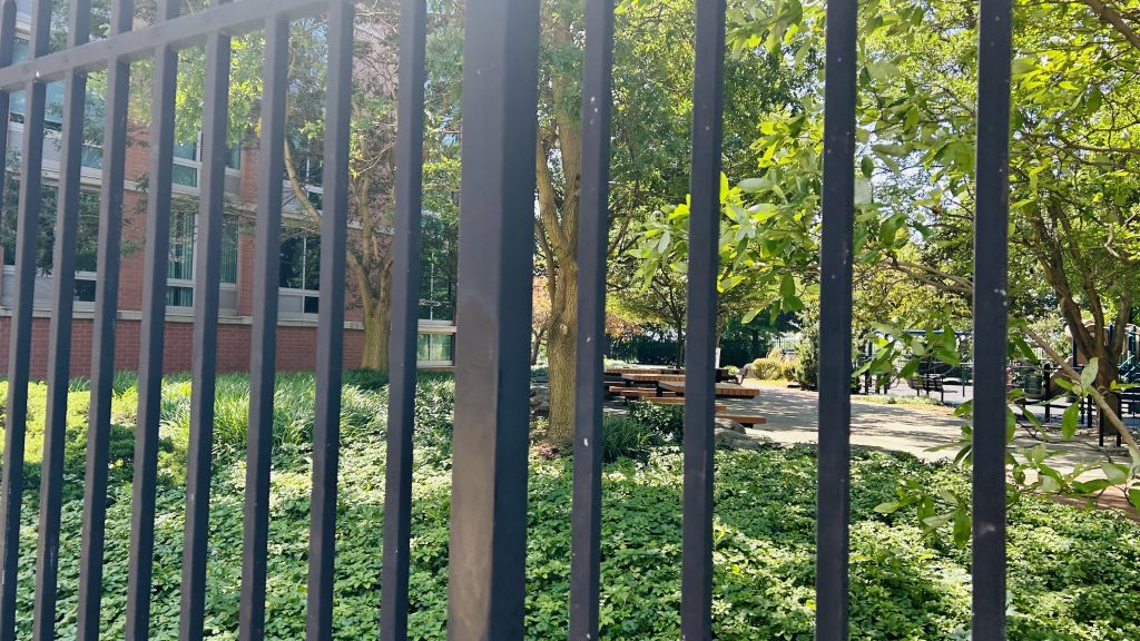
The Rockaways is a peninsula located at the southern end of Queens, and is rather isolated from the rest of the city. It also happens to be pretty well-known as a summer getaway within NYC, along with the likes of Coney Island and Brighton Beach. Now, with all that in mind…
WHAT THE HELL DOES ANYTHING ABOUT A BEACH GETAWAY DESTINATION HAVE TO DO WITH ANYTHING I WRITE ABOUT HERE?! Well, I’ll tell you what: there’s a wholeass subway (ex-LIRR) line here! And, with that, here’s the first of several (on this blog, chronologically as of me writing this) entries: Beach 25th St.-Wavecrest.
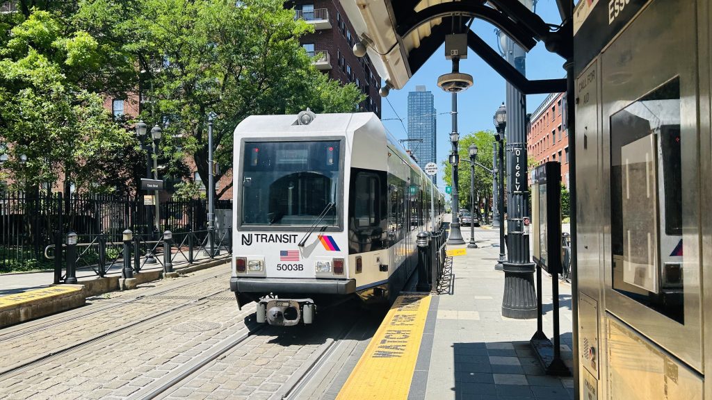
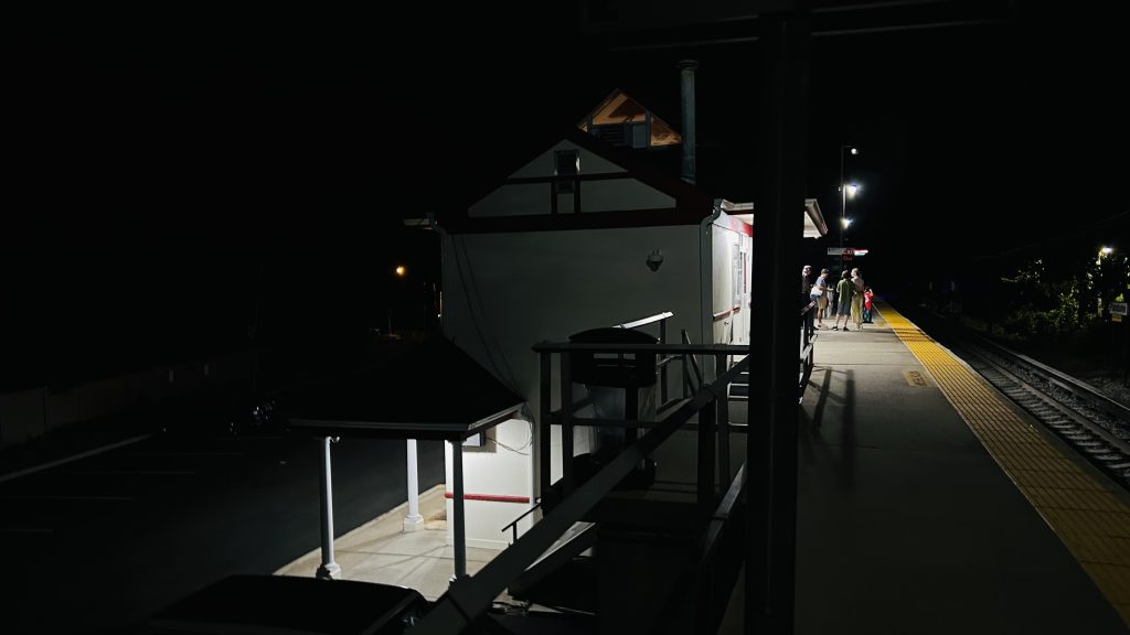
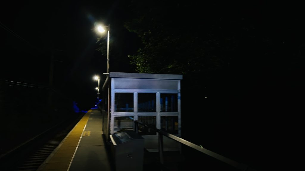
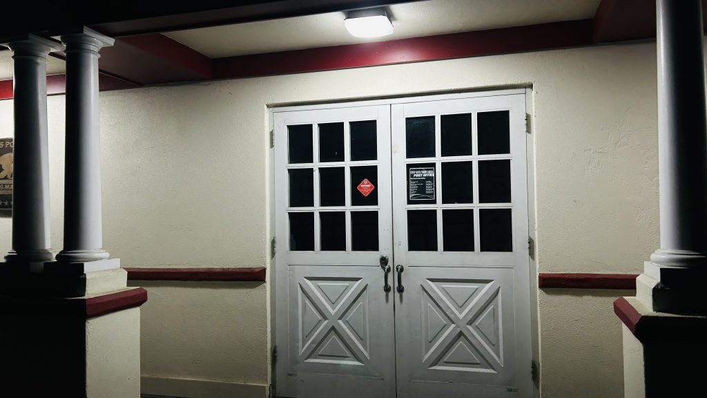
B 25 St-Wavecrest
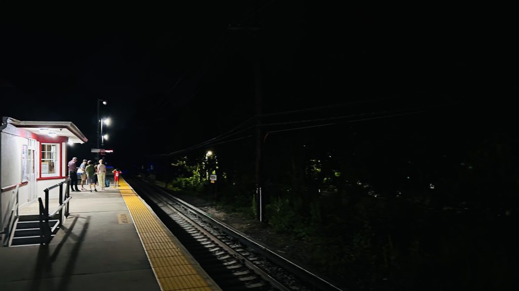
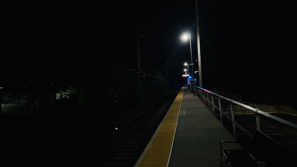
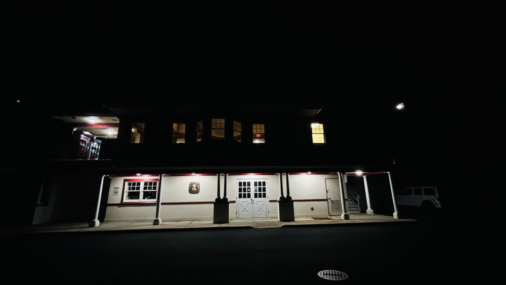
So, Beach 25th. It’s an elevated station – albeit on a concrete viaduct (ala 33rd/40th/46th on the 7 line). Is it accessible? Not really. It’s also one of the least-used stations on the system (however not THE least-used, the awards go to Beach 105th and Broad Channel). The platforms have countdown clocks, wastebaskets, benches, the usual amenities. Street level surprisingly doesn’t have bus connections within a block or two of the station – but rather within a 10-12 minute walk. So, this is one of the rare stations on the system WITHOUT a direct bus connection. As for land use around here, it’s mostly residential with a Chinese restaurant, liquor store, and convenience store at the station entrance. If you walk a little ways south, though, you’ll reach the Atlantic Ocean and apartment complexes. (I did not do this as I was planning to meet up with Honaj). There’s also a couple of parks, a high school, a couple of synagogues, a couple of churches, but by and large the area is residential. It’s also an okay place to railfan the A line.
BEACH (this was from elsewhere on the line – I just felt like dropping it here)This is a Brooklyn-bound A train. The next stop is: Beach 36th St.Platform shot w/ curveThe other side with wastebasket!And another shotBroken clock?Dot matrix signage too?!BLOODY HELLStained glass!CrossoverThe underside – and yes, concreteThe neighborhoodA little run down…Something about this just feels weird…Entrance!Train meet!Zoomed inGoing to the next stopThis was more crossing Jamaica BayAnd another Jamaica Bay shot as I go intercept Honaj at [REDACTED]
The good: It serves the local neighborhood, and the walkshed is mostly residential! And, the beach isn’t TOO far away
The bad: It’s not accessible. No bus connections(!!!). One of the countdown clocks doesn’t seem to work correctly, either.
Nearby points of interest: The beach, but that’s a bit of a ways away and there’s some stops considerably closer. There’s also some churches and synagogues, a high school, and some parks.
Transit connections: 8th Ave. (Line A)
Overall, it’s not a bad station. The vibes are a tad weird, but it’s not too terrible a station for what it is. But, for beach access, better stops exist.
The Norristown High-Speed Line? What even is this supposed to be? Ya know, whatever. Duty calls, even for what’s essentially a bus on rails, powered by a third rail. Welcome to Ardmore Junction on the Norristown HSL.
An Asea N5 railcar – and station signage
The station isn’t much to brag about, it’s literally a high-level platform that’s, at most, 2 cars long, with a shelter. Inside the shelter, there really isn’t a lot to talk about, as it’s just a bench. Because no ramp exists to get to street level, the station isn’t accessible. However, there IS a busway (that used to be the route 103 streetcar, which is now a normal bus), and that is technically accessible. There’s some bike racks and a bus shelter down there! There’s also some parking, which technically makes this a park and ride station?
Shelter!This station is very much not accessible!11ft8’s sibling?Bike racks!WARNING: ACTIVE BUSWAY!Ranya looking at the bus shelter and seating for the 103I guess it’s a park & ride???????Shelter from beneath!BUS! (in the busway)
The good: It exists! It also serves the local neighborhood. There’s also parking for those wanting to park and ride.
The bad: Inaccessible and there’s no amenities, not even a countdown clock (LMFAO).
Nearby points of interest: A park. This area is otherwise rich suburbia.
Transit connections: Norristown HSL SEPTA bus (103)
Overall, yeah, nothing to remark. This station kinda sucks.
Heading southbound on the G line, Greenpoint Avenue is the first station in Brooklyn. Located at the intersection of Manhattan and Greenpoint Avenues, this station is pretty standard for an ex-IND station. Let’s look at it.
IND TILING!!!!
The station is your standard IND station, with 2 tracks, 2 side platforms, benches, wastebaskets, countdown clocks, and the usual stuff. Surprisingly, this station is actually accessible, by way of elevators between the (rather overbuilt) mezzanine, the platforms, and street level. There’s an OMNY machine and a station agent booth as well, so it is staffed. There’s also tiling on the wall at platform level, reading “GREENPONT AVE.” and also “GREENPT”. At street level, you have connections to the B24, B43, and B62 buses. Overall, it’s not really a bad station. In terms of land use, it’s pretty normal, being the main station for the Greenpoint neighborhood. It’s also in a dense area, though not to the same degree as Midtown (though probably closer to the UES).
The G broke.GREEN PT, PT! GREEN PT, PT!Pole signagePlatform shotR46 glamor shotAnd another!The mezzanineAccessibility!I spy an R211…Towards Court Squareand towards Culver!OMNY!!!!!!Exit to street level!DUNKIESBus connection!Stereotypical Brooklyn vibesI spy a hazy LIC skyline…Is that?R211 MENTIONED!!!!!!!!!!OH HECK
The good: It’s accessible! It’s also the main station for the neighborhood (Greenpoint, Brooklyn), has decent land use (there’s stuff nearby that’s not just residential!), and is overall a decent area. For the photographers, you can even get a decent view of LIC’s skyline!
The bad: Eh, not much to say about this station. It’s not really noteworthy in any spectacular way. It gets the job done pretty well.
Nearby points of interest: There’s some shops and whatnot nearby. To the west a bit is an industrial wasteland, but other than that there isn’t much of anything notable. I guess, the Pulaski Bridge is nearby?
Transit connections: Crosstown Line (G) MTA bus (B24, B43, B62)
Overall, it’s not bad and it gets the job done in an unceremonious manner.
Newport??? Isn’t that a seaside rich person town in Rhode Island? Well……
Signage! Oh god…
Newport is located in Newport, Jersey City, and is served by PATH’s World Trade-Hoboken (Green) and Journal Sq.-33rd St. (Orange) lines. The platform configuration consists of a rather unusual island+side platform setup. Unfortunately, the station is among the most dilapidated stations I’ve ever seen at platform level, possibly even worse than Chambers St. on the J. YIKES.
Off to Hoboken with you!The other platformIt feels like a cave and not in a good way
At least, among all the blue renovation barriers, there’s elevators and this station IS accessible. I was, however, a tad scared to ride the elevator though. There was also a rather lengthy (seemingly) corridor linking the platforms as well as the headhouse, where faregates and ticketing machines exist. As for street level, the headhouse is pretty unassuming, being nestled among trees and bushes in the rather dense cityscape. Wait, what?
AccessibilityWayfinding!More corridorsCONSTRUCTION!WIDE AND OPENAnother passagewayWayfinding at fare control!The entranceThe cityscape and relatively unassuming headhouseStreet level!Wait, Pavonia/Newport?!
Not only is there also an HBLR connection, the station also goes by “Pavonia/Newport”?! Well, it turns out, ever since the Port Authority took over what we know as PATH, there’s been three other names for this station: Erie (suggesting a connection with the Erie Railroad, as their Pavonia Terminal was in the area historically), Pavonia (or Pavonia Ave.), Pavonia/Newport, and now just Newport. Yeah. Anyways, the HBLR connection is rather annoying from here, as not only do you have to cross Washington Blvd., it’s also not exactly the most obvious thing if you don’t know what to look for. Yes, it’s a passageway, but it was actually a little bit tricky for me to find. Anyways, the HBLR station. It’s pretty normal, with a level platform, ticketing machines, countdown clocks, benches, and whatnot. Oh yeah, the Newport Mall is here as well. Neat!
The HBLR station with a walkway aboveCityNerd would approve!This feels rather unassumingThis isn’t exactly accurateHBLR station signage!Train!
The good: It serves the (rather VERY dense) Newport neighborhood in Jersey City! Furthermore, it’s accessible, has buses and trolleys alongside the PATH subway, and there’s connections to both Midtown and Lower Manhattan.
The bad: The station may as well be a literal cave and the connection between PATH and the HBLR is rather annoying.
Nearby points of interest: The Newport Mall, various hotels and highrises, and the Marina Park next to Harsimus Cove. (weirdly this is closer to Harsimus Cove than the Harsimus Cove HBLR stop!)
Located deep in the Greenwich Village neighborhood of Manhattan (questionably, some will also say this is NoHo), off the beaten path where LGBTQ+ history was made in ’69, lies a college campus. The college? Well, none other than NYU, famously one of the least affordable schools in the entire country. Now, what the hell does a school that rich people (allegedly including the children of infamous US political figures that are in power as of 2025?) have to do with anything I write about here?!
Well, I’ll tell you what: They have a subway station that directly references it in the name! Meet: 8th St.-NY University.
Tiling!
So, much like 23rd St. on Broadway (& really most Manhattan local stops), the platforms are not connected within fare control (you have to cross the street), the station isn’t accessible, and the platforms are pretty bogstandard with benches, countdown clocoks, wastebaskets, and whatnot. OMNY machines are outside fare control, and there’s also a station agent here. The other side is a pretty similar story. As for what’s on street level, the headhouses are standard. There’s also not a lot nearby that’s unique to this station specifically, other than NYU’s main campus. However, on 8th Street (at the intersection with Broadway), as well as between Broadway and Lafayette St. (walking towards Astor Place station – stay tuned for that entry), you do have a number of bus connections including the M1, M3, M8, and M55 buses, while the intersection of Broadway and Waverly Place has various express bus connections including the SIM1C and X27. Oh yeah, I almost forgot to mention: the tiling in the station. There’s actually some artwork on the tiling, like at 23rd St., and it actually looks kinda nice. Admittedly, one of my favorite things for the Broadway locals between (inclusive) 28th St. and Prince Street. Not a bad station, though, if generic-ish otherwise.
Get outta here, R160!!!The columns of supportThe other sideMore standard signagePlatform shotTurnstile and rather small mezzanineARTWORK!!! (& some Palestine stickers – free Palestine!)Waverly Place? Where have I heard of that name before?MORE ARTWORK!!!E X P R E S SI’M REALLY FEELING THE HEET!!!Street level!Entry signage!DIAMOND Q?!More normal.
The good: It serves NYU as its main subway station! There’s also various bus connections here, and it’s on a decently busy throughfare. Furthermore, I like the artwork (titled “Broadway Diary”, as part of the MTA’s Arts & Design program) personally, it adds character.
The bad: Obviously, the lack of accessibility is a big one, especially being the main station for a major school in the area. Yikes. It’s also 400ft away from Astor Place, but whatever, that’s more a historical holdover to when the IRT and BMT competed. I don’t really have much to say about this station though.
Nearby points of interest: To this specific station? Probably NYU mainly. There’s also various shops along Broadway, Cooper Union (though much closer to Astor Place), and even Washington Square Park (of which West 4th is considerably closer).
Transit connections: Broadway Lines (R, W) MTA bus (M1, M55, SIM1C, SIM3C, SIM4C, SIM7, SIM9, SIM33, SIM33C, X27, X28 at Broadway/Waverly Pl., M1, M2, M3, M8, M55 at 8th St./Mercer St.) NYU shuttles
Overall, it’s by no means a terrible station, and the artwork adds a bit of character to an otherwise generic copy-paste station.
Ah, the Staten Island Railway…..what a weird line. Well, the 20 someodd stations located on Staten Island are all contained to a singular line isolated from the rest of the system. Richmond Valley happens to be no exception. Without further ado, here’s the first SI Railway entry on this blog.
Signage!And an R211S!
The station is famous for one thing – and it is not a good one: THE LAST CAR OF THE TRAIN DOESN’T PLATFORM!!! Yeah…. Ah well, that aside, it’s pretty standard – albeit for more of a commuter railroad station. There’s wastebaskets and benches. Stairs provide access to the other side of the tracks as well as to Richmond Valley Road. Furthermore, there’s neighborhood access without using the stairs to each side as well. It also looks like there may have been a grade crossing here many moons ago? Not sure though. As for the surroundings, there’s a bus connection to the SIM26 on Amboy Road, a house or two, a printing company, a smoothie shop, and not much else. This has got to be one of the most rural-feeling subway stations I’ve ever seen.
Onwards!Looking towards St. George. (& a railfan is present as well it seems)Overpass!And without the trainWhat.HOSTILE BENCHESNeighborhood exitCanopyOverpass shot!StairsRather unassumingOne such local spot – and Honaj?!AHH TWO ELEVEN!!!…an R44?!
The good: It serves the local area! It’s also rather vibey, even if unassuming. Although, that could easily apply to the entire SI Railway outside the northernmost bits.
The bad: No accessibility, and the last car doesn’t platform. Yuck.
Nearby points of interest: There’s a smoothie shop!
Transit connections: SI Railway MTA bus (SIM26)
Overall, as I said earlier, this has got to be one of, if not THE single most remote-feeling stations on a subway system that I’ve ever seen and been to.
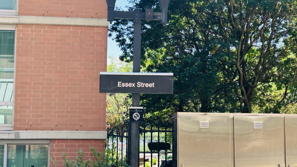
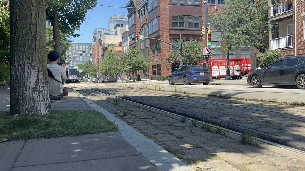
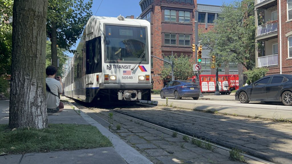
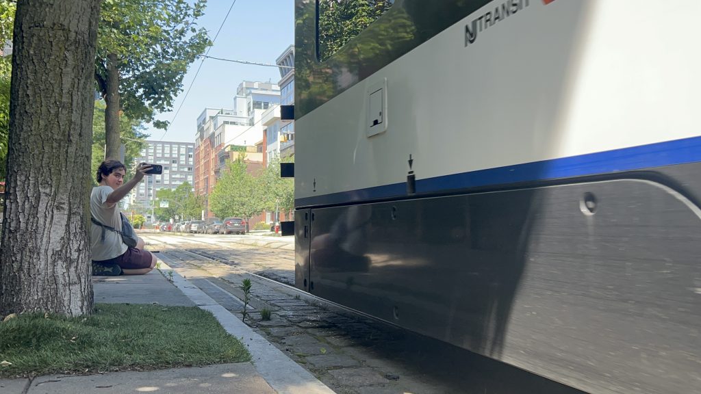
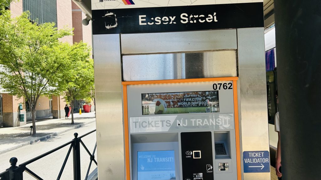
Essex St. Station is a station located in Jersey City, served by the Hudson-Bergen Light Rail, and opened in April 2000 as one of the HBLR’s original stations. Let’s take a look.
Signage!
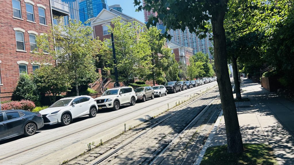
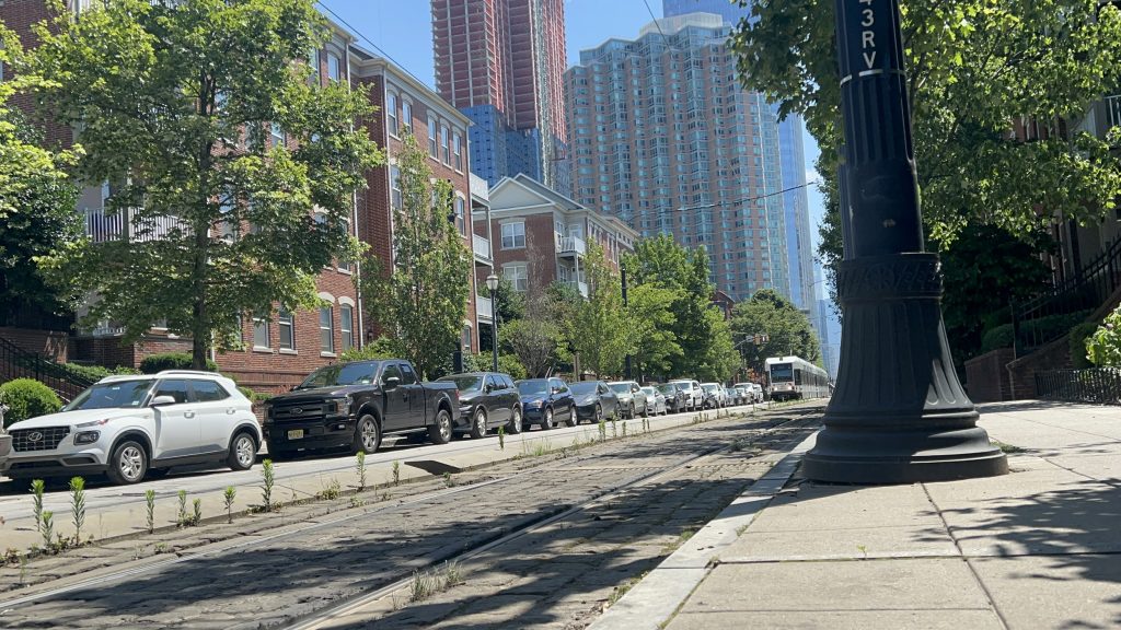
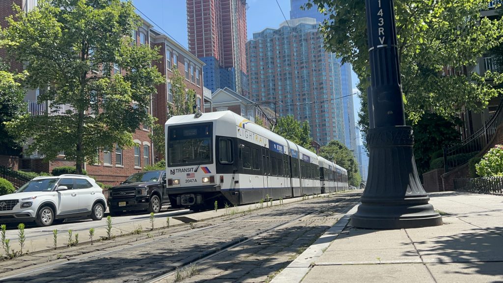
The platform is rather normal, being low-level and featuring level boarding with the Kinkisharyo streetcars that are used. There’s some benches and a ticket vending machine and……a ticket reader????? Yeah, I’m not exactly sure why they need machines to read the tickets or what “validating” it does – isn’t buying the ticket good enough?! Unfortunately, when I first rode the HBLR a couple of days prior to coming here, I didn’t know this and may have accidentally fare evaded – and experienced culture shock when I found out that the HBLR runs on the honor system alone, rather than have fareboxes at either/both ends of the car. Yeah, I was bewildered. Whoops. Anyways, there’s also some shelter from the elements, but it’s not exactly enclosed. As for land use around the station, it’s actually pretty dense and pretty good, given it’s Jersey City. There’s also a park nearby, neat! Lastly, this area is also a decent place to railfan the HBLR.
yuck. street parking. goddammit, Steve Fulop!FOAMER SHOTHBLR streetcar!And heading towards Marin Boulevard – and hi, Honaj!waowHONAJ FOAMS REALLY WELLTicketing machineAnother trolleyThe other platformILLEGAL? (no, this was legal)I spy lower Manhattan…Park!
The good: It’s in a dense area! (the station came first, as far as I’m aware) Furthermore, there’s the standard amenities you’d expect – plus ticketing machines. Where I’m from (the Boston area), you’d be LUCKY to have a TVM on a surface-level station. Lastly, the land use is actually really good around here.
The bad: Do the countdown clocks work properly? Actually, I don’t even recall seeing one. There’s also not a proper enclosed shelter, but whatever. There’s also no real bus connection here, but also not a dealbreaker with how short a walk it is to the nearest real connection.
Nearby points of interest: The Colgate clock is nearby! There’s also some green spaces and a few restaurants and shops.
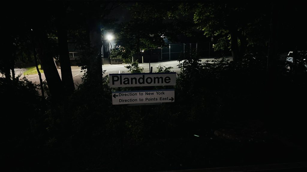
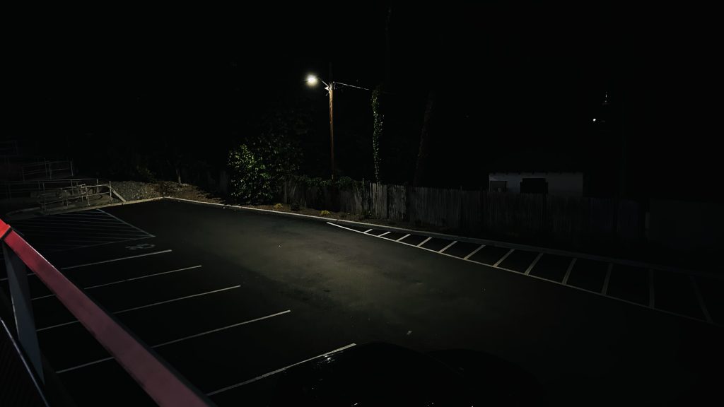
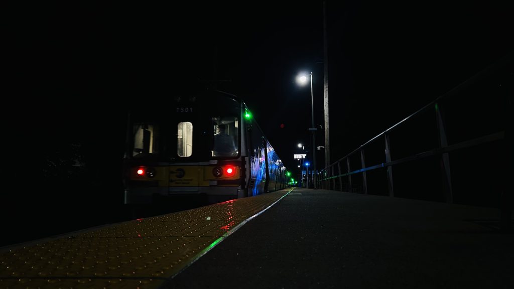
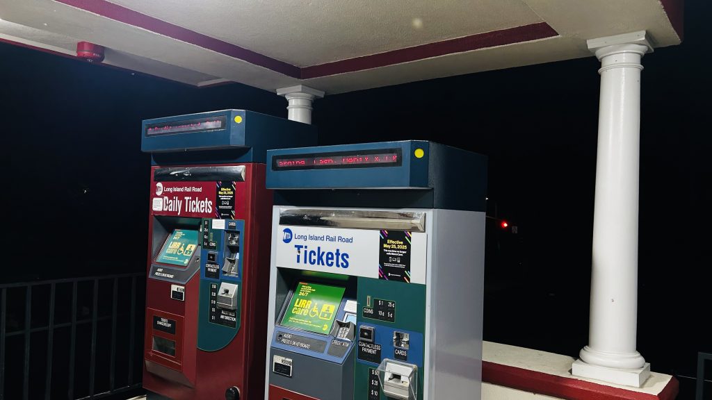
shh, the rich republican nimbys are asleep, i gotta be quiet here. anyhow, welcome to the least-used port washington line station: plandome.
’tis a bit dark
plandome station consists of a singular side platform and a singular track, going above stonytown road and is next door to a country club. it’s got your usual station amenities, including a bus shelter on one end of the platform, a ticketing machine, a waiting room (surprisingly – but it was locked) which has a restroom(!!!), a ramp, stairs, and some parking. the station house also happens to house the local post office, which is pretty cool in its own right! as for other connections, it’s got nothing. the nearest connection is a rather dicey walk to nice’s n23 bus to manorhaven and mineola, on port washington boulevard, over a mile away. no thanks. overall though, it’s not a terrible station, even though i felt out of place in one of the most affluent (& rather republican) parts of the entire northeast (that i’ve been to so far). overall though, not a terrible station, but 0/10 for affordability and i’d presume nimbyism is at an all-time high.
parkingtrainstation houselooking towards woodside and manhattanand towards the next/last stop: port washingtonaccessibility!bus shelter, but larger. also, what’s with the uv lighting further up?the streetstairsthe lot at street levelthe post officeliminal!the overpassi spy a ticketing machineand a tad closerinside (it was locked)
the good: it’s accessible! furthermore, there’s a modest amount of parking, and it’s primarily here to serve the local neighborhood. there’s also a post office in the waiting room, and the fact there’s even a waiting room open during daytime hours at all is nice!
the bad: the land use, but this is a super rich and super nimby area. also no bus connections, which again is likely nimbyism at play.
nearby points of interest: that country club, if you’re rich. if you’re working class like i am, absolutely nothing.
transit connections: lirr (port washington)
overall, it’s not a bad station, and actually kinda vibey at night! it’s just really, really affluent and republican though.
So, after a quick hop on the L line from Arrott to Frankford, Honaj (& Ranya – go check out her blog!) and I ended up at Frankford’s busway. So, why the hell am I doing a blog entry about a bus that goes all the way out to the city line and almost into Bensalem Township (but doesn’t leave Philly)? Well, I’ll tell you why: much like the 59, it uses trolleybuses instead of normal buses!
…express?!
Wait, what’s this? EXPRESS?! You mean to tell me they put catenary on I-95?!
…no, not quite. While that would be quite funny to see a trolleybus on overhead wires running down I-95 at the legal max speed (55 miles an hour), that isn’t what’s happening here. Allow me to explain.
There’s actually two ways a bus can run “express”, so to say. The first is the obvious answer: use the damn highway. RIPTA does this for a number of routes that run express for at least part of the run. The MBTA does this for routes like the 111, the Silver Line, the 501/504/505, the 354, among others. CTtransit does this mainly with their commuter coach routes (in the 900s), but some (such as the 201) do have limited highway running. And, lastly, the MTA does this with their commuter buses and things like the M60-SBS and Q70-SBS to get in/out of LaGuardia Airport. The other way…….is to just use the inner lanes of traffic. I guess this is more “limited stop” than a true express, if anything. RIPTA’s QX and 24L are the only other examples I can think of, where in parts of it, it’s a local route on paper, but in practice it makes zero stops. The 66 does this for its “express” runs.
Ok, now that that’s out of the way, how the hell do trolleybuses overtake each other then?! That’s literally one of the biggest downsides of trolleybuses, is that they can’t overtake one another. Well, the Philadelphia Transportation Corporation (SEPTA’s predecessor) thought about this and did the “well no shit, Sherlock!” solution: just install a second pair of wires in the same direction each way. And thus, for a section of Frankford Ave., you have 4 sets of catenary: one for each lane. Anyways, let’s check out the route itself!
Onwards!
The route itself is largely relatively unremarkable other than the equipment it uses, being a straight shot down Frankford Avenue to either the Gregg St. loop, or the City Line loop on the Philly/Bensalem Township border. Trips heading towards either bus turnaround have to do a weird maneuver to get out of the Frankford TC’s general vicinity, though. Other than that, all is pretty normal. The road is rather stroady, though, but there’s also some degree of density to be had. In fact, some of the areas even seem rather nice at face value. Hell, the closer you get to Bensalem Township, the more suburban things get. I’m not sure how to make of it, though. But, there IS something cool along this route: Pennypack Creek! One of the oldest bridges in the country – and it has overhead catenary for the trolleybuses. Neat! Moving along, Gregg Street is where some runs will short-turn, while others will continue on to City Line Loop. The rest of the way there, however, is largely unremarkable – and gave off increasingly suburban vibes. NIMBY vibes too? Maybe? The fact a trolleybus even runs out here throws the vibe detector off. Either way, we pass a strip mall with a Dunks, what looks like cookie cutter housing, and enter the City Line loop short of the Bensalem Township boundary. And with that, concludes the 2nd of 3 trolleybus routes. (yeah, sorry, I didn’t ride the 75 on this trip)
A garageThe yardHousing!This street feels rather narrow…Something feels a tad off here…I WALKED TO BURGER KING…More stuffWe have Red Robin at home.More housing over yonderoh my more stuffA side streetAnd another – with signage for US-13HURT AT WORK?treeartwork!LEASING!WOAHOLDEST BRIDGE?!PENNYPACK CREEK!!!OH NO, DOTS!!!A tad more fancyA strip mallD I N E R (as famously seen in the Miles in Transit Philly Diner Video)THE HOLY LANDEXPRESS (diamond 66?)ANOTHER TROLLEYBUSGot the Midas Touch?AND ANOTHER TRAMBUS!!!fieldWelcome to Torresdale, Philly?cookie cutter housing?ugh…Another intersectionTROLLEYBUS RAAAAAAAAAAAAAAA!!!!!!!!!!!!!!!!BUS CONNECTION.
The good: It’s frequent! (every 7-12 minutes during peak hours, every 15 otherwise, and every half-hour overnights!!!!!!!) Furthermore, it serves some somewhat dense areas, goes all the way to almost Bensalem Township, and isn’t even noticeably loud. Furthermore on top of that, did I mention it runs 24/7? Yeah. It also runs “express” service!
The bad: I…..genuinely don’t have much to say that suggests this is bad.
Nearby points of interest: Housing. A diner. If you’re willing to walk a mile or so, Four Seasons Total Landscaping (if ya know, ya know). Some churches and cemetaries. A golf club. Torresdale’s Regional Rail station, and the Frankford TC.
Overall, it’s not that bad. If anything, dare I suggest it’s possibly even a 10/10 route?! Because, truthfully, this has the makings for a 10/10 route.
Ah, golly, a SEPTA bus route review! Well, Honaj dragged me all the way to the Bells Corner bus loop at Castor & Bustleton Avenues, after taking a ride down the Fox Chase Line (entry on Fox Chase Station coming at some point!), going to a Wawa (THE HOLY LAND), and a quick ride to Castor & Rhawn, and we got off and walked the half-mile to the Bells Corner Loop. Wait a second, what the hell?!
AAAAAAAAAAAAAAAAAAAAAAAAAAAAAAAAAAAAA NO NO NO NO NO NO NO NO GOD NO
NO. NO. NO. NO. NO. DAMN YOU, HONAJ!!!!!!!!!!! WHY WOULD YOU LEAD ME RIGHT INTO A TRAP?! NOT THE GODDAMN TROLLEYBUSES!!!!!!!!!
HONAJ: “TROLLEYBUS! TROLLEYBUS! TROLLEYBUS!!!” ME: *stares in horror*
*sighs, blinks twice for help*
Okay, okay, I guess I have to answer the call of duty here with these shit buses. Well, rather than being garbage Neoplans, at least we have….let’s see…..New Flyer E40LFRs. Well, maybe New Flyer actually knew what they were doing. The buses…….were largely dead silent, even moreso than RIPTA’s BEBs (which were already pretty much dead silent to begin with!!!), these suckers REALLY took off when given a chain of green lights and negligible requested stops/boardings (which is not too common seemingly given the REALLY, REALLY TIGHT stop spacing on SEPTA – every single block!), and furthermore it……….actually didn’t crawl like absolute dogshite. But, before I continue, I have to review the route itself.
VS. them trolleybuses (ft. Honaj & co., offcamera)
The 59 originates at the Bells Corner bus loop, at Castor & Bustleton Avenues, and is largely a straight shot down Castor Avenue. Running through northeastern Philadelphia, it goes through the Rhawnhurst and Oxford Circle, before negotiating the rather oversized rotary bisected by U.S. Route 1 (Roosevelt Boulevard locally), and going down Oxford Avenue. Ultimately, the route then terminates rather unceremoniously at the Arrott Transit Center, with the interchange to the L (aka the MFL, Market-Frankford Line, or if you’re weird the Blue Line – this blog will be calling it the L as that’s what SEPTA calls it nowadays). Overall, in terms of scenery, there’s really not a lot exciting going on other than Roosevelt Boulevard. In terms of vibes, though these neighborhoods, I get some Boston vibes, some south Providence vibes, but ultimately I really couldn’t pin anything specific down – Philly is kinda its own thing vibe-wise. In terms of headways, it’s about every 20 minutes for much of the day offpeak, with weekend and night service being half hourly to every 40 minutes (it is not a 24 hour route). Overall, not bad!
I think that’s Ranya boarding the bus?See ya later, Bells Corner!H O U S I N G S T O C KAn elementary school!A Catholic Church!More housingeven moreA Citizens Bank w/ some catenaryDUNKIESSSSSS!!!!!!!!!One nice things about these suckers is you can look out the rear windowTROLLEYBUS VS. ROTARY: WHO WILL WIN?!Some local businessesSEPTAMORE HOUSING!!!AND EVEN MORENear the endEnd of the route w/ Honaj
The good: It serves a rather dense (if not highrise-ridden) neighborhood! The buses themselves, too! (I’ll elaborate soon) The headways are also okay, for weekday service! It’s also got connections to the L via Arrott!
The bad: Weekend headways could be better. The bus loop terminus does seem kinda weird at face value too, but I’ll save rambling on about that for the entry specifically for Bells Corner (whenever that comes out)
Nearby points of interest: Bells Corner has a shopping center nearby, there’s a Wawa, a few schools and churches along the route, a LOT of housing, and a decent amount of local businesses lining both Castor and Oxford Avenues
Overall, not a bad route!!!
Rating: 8/10
Wait, wait, wait just a hot flippin’ moment… did……did I find a GOOD piece of trolleybus equipment?! You mean to tell me it’s NOT utter and complete dogshit, is pretty much silent, and actually isn’t horrifically slow?! And my life was a lie!!! Or, at the least, my life was all in misguided anger?! IT’S NOT SHIT?! IT’S NOT SHIT! IT’S NOOOOOOOOT SHIIIIIIIIIIIIIIIIIT!!!!!!!!!!!! Y’ALL FOOLED THE PUBLIC AND TOLD THEM TROLLEYBUSES COULDN’T BE GOOD AS THE WAY OF THE FUTURE, MR. STEVE POFTAK!!! YOUR LEADERSHIP LED THE FREAKIN’ MBTA DOWN THE WRONG PIPELINE, WHY WOULD YOU REPLACE SOMETHING THAT WAS PERFECTLY FUNCTIONAL AND VERY MUCH NOT GARBAGE WITH SPARKY SPARKY BOOM MACHINES?! WHAT WERE Y’ALL SMOKING?! WHO IN THEIR RIGHT MIND THOUGHT IT WAS A GOOD IDEA TO MISLEAD PUBLIC OPINION AND THE OPINIONS OF EXECS TOWARDS “let’s dismantle them trolleybuses!!!”?! YA KNOW, MAYBE IF YOU NEED AN EXEMPTION TO BUY AMERICA, THAT’S A BAD SIGN, TO PUT IT LIGHTLY! And with that, I am hereby proposing “throw them wires up at Logan Airport, the Seaport, and in the Chelsea busway – and do NOT let Neoplan rise from the dead to do the deed”
I guess…….my disdain for trolleybuses, should’ve been more “fuck Neoplan” in particular and was horrifically misguided. I hereby retract all the ranting about how garbage they were, in the Harvard Square blog entry. Although, I’ll still keep it and not edit it for old time’s sake and in the name of keeping it as a museum piece of a bygone era of the Chelsea’s Corner blog.
A MFL train, but heading towards Upper Darby, rather than to Frankford (next entry…)
*cries in a corner realizing all the hate for trolleybuses since the birth of this blog is actually all misguided and should’ve been directed towards Neoplan instead*